MapServe® has launched a powerful new roof attribution layer built on the latest data from Ordnance Survey’s National Geographic Database (NGD). Delivered as an additional layer to OS MasterMap®, it’s designed for building professionals—architects, surveyors, planners, and retrofit consultants—bringing a new level of precision and usability to your site assessments, planning decisions, and energy-efficiency modelling.
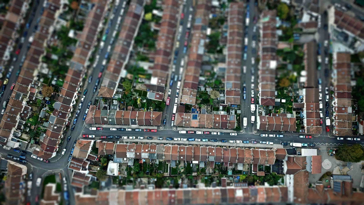
With detailed roof information now available across more than 40 million buildings in Great Britain, this enhancement isn’t just about data—it’s about enabling smarter, faster and more confident decisions.
What the New Roof Data Offers
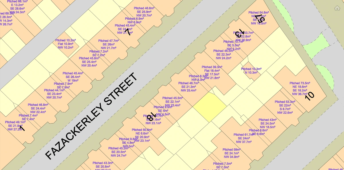
The new layer includes four key attributes for every building in the national dataset:
-
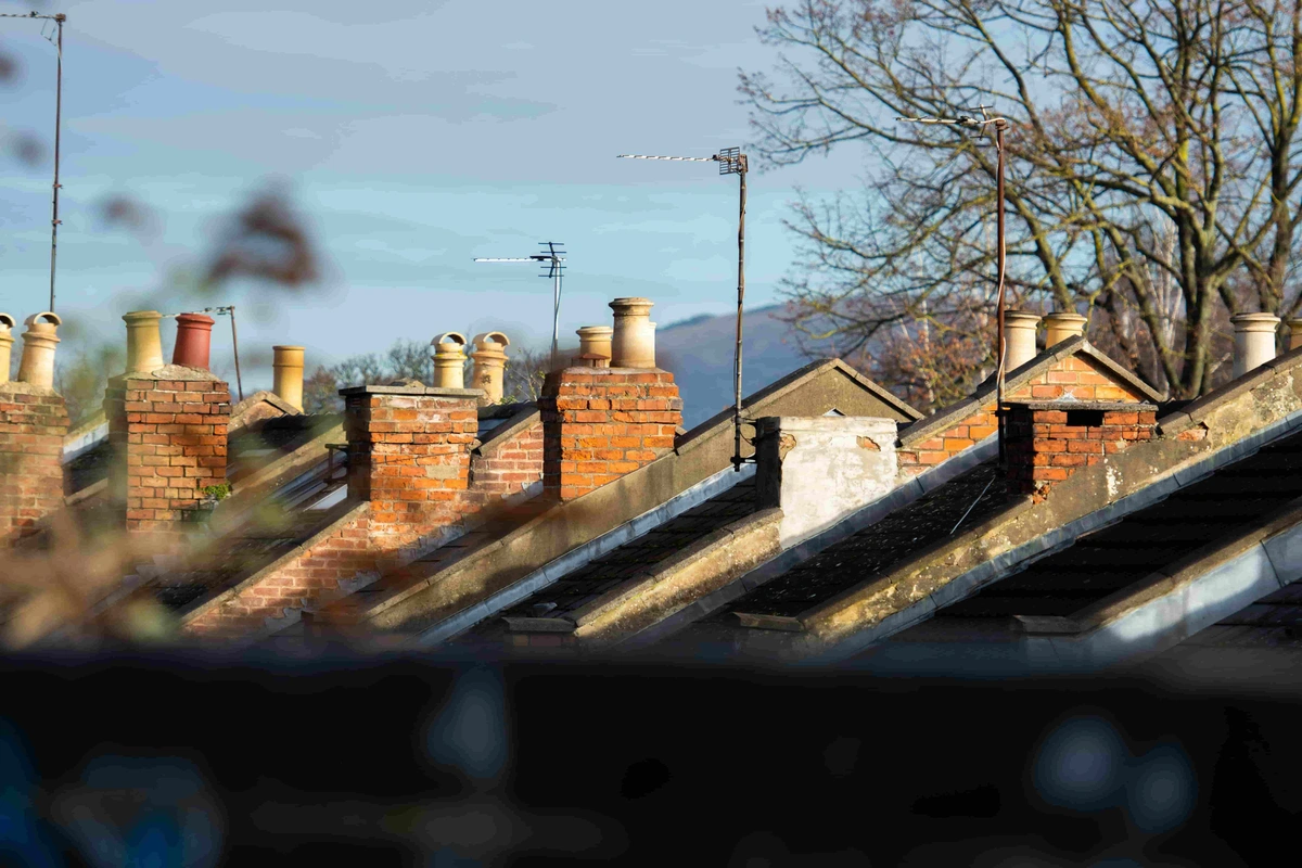
Roof material type (e.g. slate, tile, metal)
-
Presence of solar panels
-
Presence of green roofs
-
Roof shape (e.g. flat, gable, hipped)
-
Roof orientation (aspect in relation to cardinal directions)
This information is derived using advanced automated feature extraction from aerial imagery, allowing for consistent national coverage and frequent updates. The entire dataset is refreshed on a rolling three-year basis, with approximately one-third of Britain updated annually under OS’s National Cyclic Revision (NCR) programme.
Why This Data Matters to Professionals
Architects & Urban Designers
-
Design Compatibility: Knowing the roof shape and orientation at early stages allows for context-sensitive designs, especially when working in areas with architectural conservation restrictions or when planning extensions.
-
Environmental Modelling: Orientation and material data support solar shading analysis, passive design strategies, and thermal modelling during RIBA stages 1–3.
-
Planning Submissions: Provide evidence-backed details to support your proposals, especially where height, roofline, or visibility impact assessments are required.
Surveyors & Building Inspectors
-
Rapid Validation: Cross-reference reported roof materials or features against accurate roof data without the need for physical access in early due diligence phases.
-
Retrofit Readiness: Determine which properties are suitable for retrofit upgrades—like solar installations or green roof systems—by checking shape, orientation and existing infrastructure.
-
Condition Assessments: Prioritise survey focus based on known roof types, for instance identifying flat roofs with known drainage risks or older tile systems prone to weathering.
Retrofit & Sustainability Consultants
-
Target Solar-PV Opportunities: Identify buildings with south-facing roofs and no existing solar panels for cost-effective PV deployment under programmes like ECO4 or Home Upgrade Grant schemes.
-
Model Insulation Impact: Use roof material and form to model thermal performance, informing recommendations on insulation strategies and retrofitting.
-
Green Infrastructure Mapping: Track green roof adoption across regions to support planning applications, environmental performance audits or grant reporting.
Planners & Local Authorities
-
Evidence for Local Plans: Map existing solar uptake and roof orientations to forecast renewable energy potential in new or existing neighbourhoods.
-
Urban Heat Island Mitigation: Identify areas lacking green roofs to guide future environmental planning or resilience strategies.
-
Conservation Area Oversight: Confirm if existing roof shapes align with historical or conservation guidelines and detect alterations that may need enforcement.
Insurers & Risk Assessors
-
Material Risk Profiling: Know which buildings use high-risk materials—like metal for lightning exposure or tile types prone to freeze-thaw damage—and adjust premiums or inspections accordingly.
-
Claims Verification: Validate claims related to roof material or solar panel loss without relying solely on client-provided data.
-
Fire & Wind Risk Audits: Assess roof geometry and materials to estimate risk exposure in areas with known severe weather events.
What Makes the Data Reliable?
-
Authoritative Source: Derived directly from Ordnance Survey’s mapping and aerial photography, which underpin government, utility, and infrastructure datasets across the UK.
-
Nationwide Consistency: Data available across the whole of Great Britain with uniform classifications and quality assurance.
-
Automated Extraction: Built using machine learning and computer vision techniques, eliminating human error and bias, while enabling rapid updates.
-
Rolling Updates: 30% of the country’s building data is refreshed annually, meaning high coverage and up-to-date information is always within reach.
How MapServe® Users Benefit Immediately
MapServe® has integrated this data into an easy-to-use, visual roof layer available on the platform for professionals needing instant access to building intelligence.
-
Quickly identify the orientation and structural form of any roof.
-
Highlight buildings with solar or green infrastructure for project scoping or regulatory reporting.
-
Print or export maps showing roof types for planning submissions, design reports or site assessments.
-
Access supporting data to back claims, justifications or applications—such as matching roof geometry with local planning policies.
A Shift Towards Smarter Built Environment Data
The release of this roof layer comes at a pivotal moment for the UK construction and planning sectors:
-
Decarbonisation Targets: The UK government’s push for net-zero by 2050 puts pressure on professionals to deliver low-carbon solutions. Accurate roof data enhances solar modelling and retrofit targeting.
-
Local Plan Revisions: Councils are revising local plans with embedded sustainability requirements. Being able to assess and report on roof material and shape aids compliance.
-
Insurance Industry Scrutiny: Following increased weather extremes, insurers are demanding higher data standards to mitigate losses and prevent fraud—making reliable roof data a valuable tool.
Use Cases in Practice
If you're working in the built environment, the new roof layer could become a valuable part of your decision-making toolkit. Here’s how professionals across different sectors might make the most of it:
-
Retrofit & Energy Planning: If you're involved in delivering energy upgrades under schemes like ECO4 or PAS 2035, this data can help you quickly identify properties with optimal roof orientation and material for solar PV installations—without waiting for site visits.
-
Heritage and Conservation Review: Planning in or near conservation areas? You can use roof shape and material data to assess whether proposed developments are in keeping with local character, reducing the risk of planning objections and delays.
-
Green Infrastructure & Urban Planning: For those developing green infrastructure strategies, this layer offers a way to map existing green roofs and identify gaps—supporting policy reports, grant applications, or biodiversity planning.
-
Insurance & Risk Assessment: Insurers assessing weather or fire risk could use verified roof materials and geometry to inform exposure modelling—particularly for properties in high-risk zones or with older construction types.
-
Research & Policy Development: Universities, think tanks, and local authorities could analyse patterns in solar panel distribution or roof types across urban areas, using the data as a baseline for climate adaptation, planning reform, or housing policy.
Whether you're evaluating risk, planning an intervention, or writing a policy paper—this roof data isn't just informative, it's actionable.
The new roof layer available through MapServe® is more than a data upgrade—it’s a foundational tool for modern professionals across the built environment. By making verified, high-quality roof information easily accessible, this layer opens new possibilities for design, compliance, sustainability, and planning.
Whether you’re modelling solar yield, validating construction materials, or planning sustainable developments, this dataset adds the clarity and confidence needed to make every project decision smarter.
You can download a roof layer sample through MapServe®'s website.