Free to view MasterMap®
Download in a few minutes
Save up to 40% vs. other suppliers


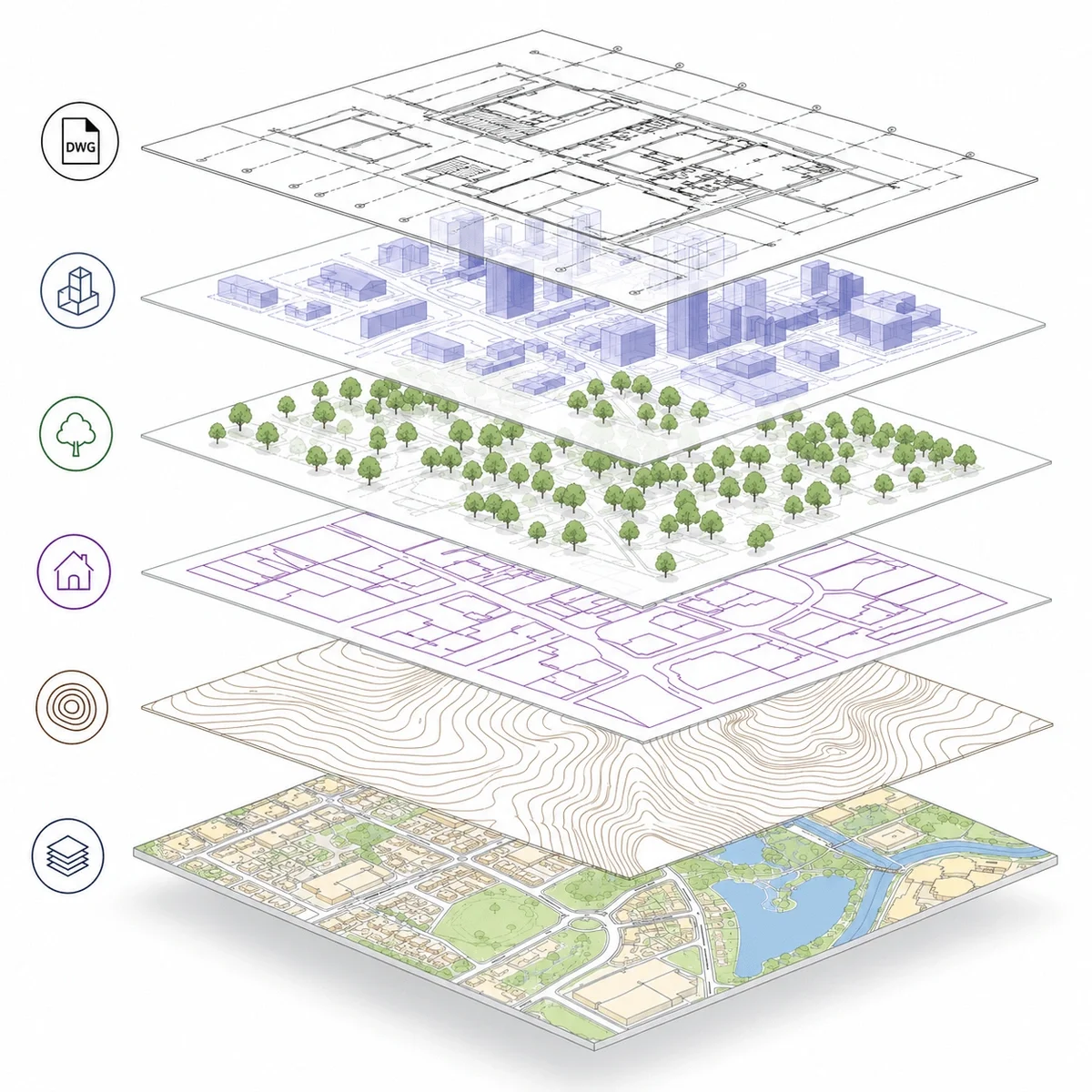
DWG Plans are CAD mapping files supplied in Autodesk .dwg format, allowing architects, surveyors, planners and engineers to use detailed mapping directly within CAD software without converting from PDF or image files.
They provide structured, editable mapping of buildings, roads, boundaries and land features, making them suitable for use as a base plan in architectural drawings, site layouts and technical workflows.
MapServe DWG Plans are derived from OS MasterMap®, ensuring accurate, reliable mapping that integrates seamlessly into professional CAD environments. Plans can also be enhanced with optional layers such as 1m contours, freehold boundaries, building heights and National Tree Map™ data.

| Sector | Need | Why it's used | Typical format |
|---|---|---|---|
| Architecture | CAD base plans | Start design and planning drawings quickly | DWG |
| Surveying | Mapping reference | Compare CAD mapping with survey outputs | DWG |
| Planning | Site drawings | Prepare overlays and supporting drawings | DWG |
| Engineering | Constraints review | Assess roads, buildings, boundaries and access | DWG |
| Development | Feasibility | Review site layout and context early | DWG |
| Map product | Best used for | Key limitations |
|---|---|---|
| DWG Plans (OS MasterMap® based) | CAD-ready base mapping for design and technical workflows | Does not include verified site measurements or construction detail |
| PDF plans | Visual reference and planning submissions | Not editable or suitable for CAD workflows |
| Measured topographic survey | Accurate site levels and physical features | Requires on-site survey work and is typically more expensive |
| GIS data formats | Spatial analysis and large datasets | Not optimised for CAD design workflows |
DWG Plans are derived from OS MasterMap® data and provide a reliable base for design work, but they should not be used where verified, site-specific accuracy is required.
They do not replace measured topographic surveys where exact levels, drainage, tree positions or physical features must be confirmed. DWG Plans also do not define legal ownership or boundaries and should not be used in place of title plans or Land Registry documents.
For construction, setting out or legal matters, additional surveys and documentation will be required.
| Attribute | Description |
|---|---|
| Format | DWG |
| Data source | OS MasterMap® |
| Layer structure | Organised CAD layers for buildings, roads and features |
| Optional layers | Contours, freehold boundaries, building heights, National Tree Map™ |
| Best used for | AutoCAD, CAD base mapping, planning and design |
| Delivery | Within seconds of ordering |
| Coordinate system | British National Grid (OSGB36) |
| Compatibility | Suitable for AutoCAD and other CAD software |
| Features included | Buildings, roads, boundaries and physical features |
A DWG plan is a CAD drawing file that can be opened and edited in AutoCAD and compatible CAD software.
Yes. DWG Plans are suitable for preparing planning drawings and design overlays.
Yes. You can add 1m contours, freehold boundaries, building heights and National Tree Map™.
DWG Plans are used as base mapping in CAD software for design, planning and technical drawings.
Yes. MapServe DWG Plans are derived from OS MasterMap® data.
They can support planning drawings, but specific Planning Maps are usually required for formal submissions.
Not by default. Contours and elevation data can be added separately if required.
Yes. DWG Plans are fully editable within CAD software.
DWG files can be opened in AutoCAD and other compatible CAD software.
DWG Plans can typically be produced quickly once the site and requirements are confirmed.


