
This post shows why TPO maps should be checked before a planning application to reduce redesign risk, validation delays and missed arboricultural requirements.
19 Jun 2026

This post explains how architects, planners and developers can check whether a site is affected by Tree Preservation Orders before design work, tree works or planning submission.
19 Jun 2026
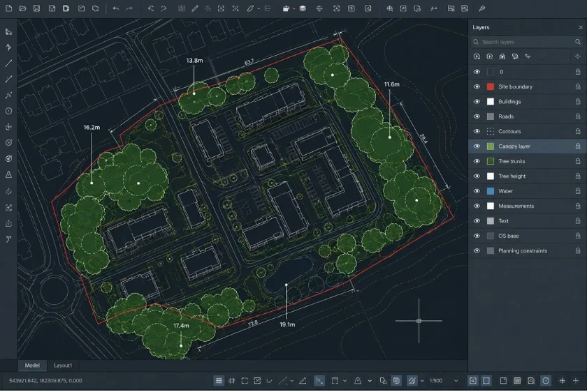
A CAD-focused guide showing architects and surveyors how tree canopy data in DWG or DXF can improve site analysis, feasibility checks and planning workflows.
18 Jun 2026

A practical guide explaining how early tree constraints mapping helps architects, planners and developers identify canopy, access and layout risks before design or planning work progresses too far.
18 Jun 2026

Tree Preservation Order data is fragmented across councils, making site assessments slower and more difficult than they should be.
11 Jun 2026

This guide explains how to buy the right site plan online by choosing the correct format, scale, coverage and mapping data for planning, CAD design, feasibility or presentation workflows.
30 May 2026

OS maps provide a recognised base for planning applications, but clear scale, coverage, boundaries and export quality are what help reduce validation delays.
27 May 2026

OS map DWG downloads give architects, planners and surveyors editable Ordnance Survey mapping for faster CAD-based planning drawings, site appraisals and early design layouts.
21 May 2026

This blog post explains how CAD site plans help architects, surveyors and planning consultants save time, reduce manual tracing and create editable base drawings for planning, feasibility and early design work.
15 May 2026