


Free to view MasterMap®

Download in a few minutes

Save up to 40% vs. other suppliers
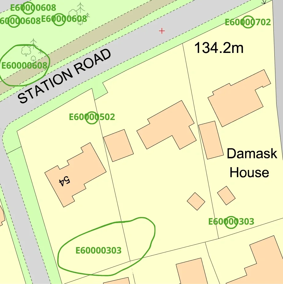
Tree Preservation Order mapping - identify protected trees and TPO constraints affecting development sites.
Planning and arboricultural support - useful for planning applications, site assessments and land analysis.
Protected tree and conservation context - understand tree-related planning constraints before development begins.
Site-specific TPO maps and overlays - suitable for planning, environmental and professional workflows.
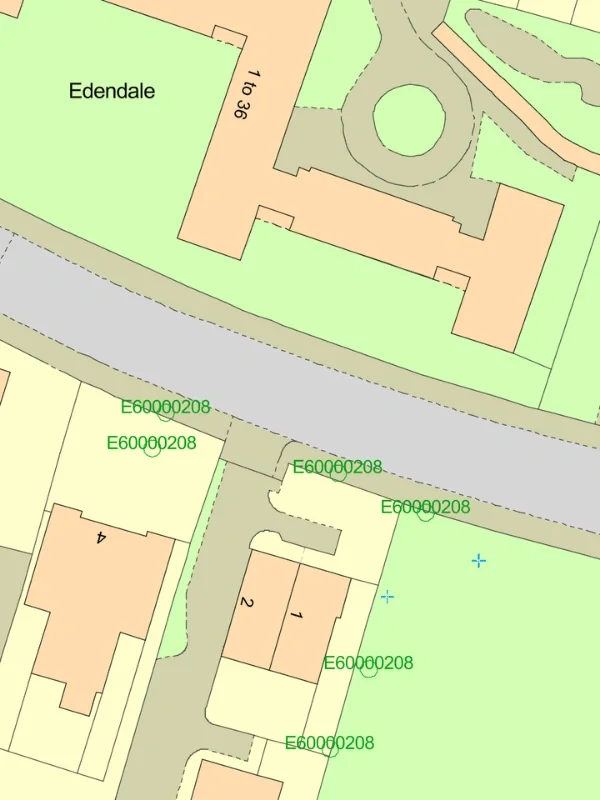
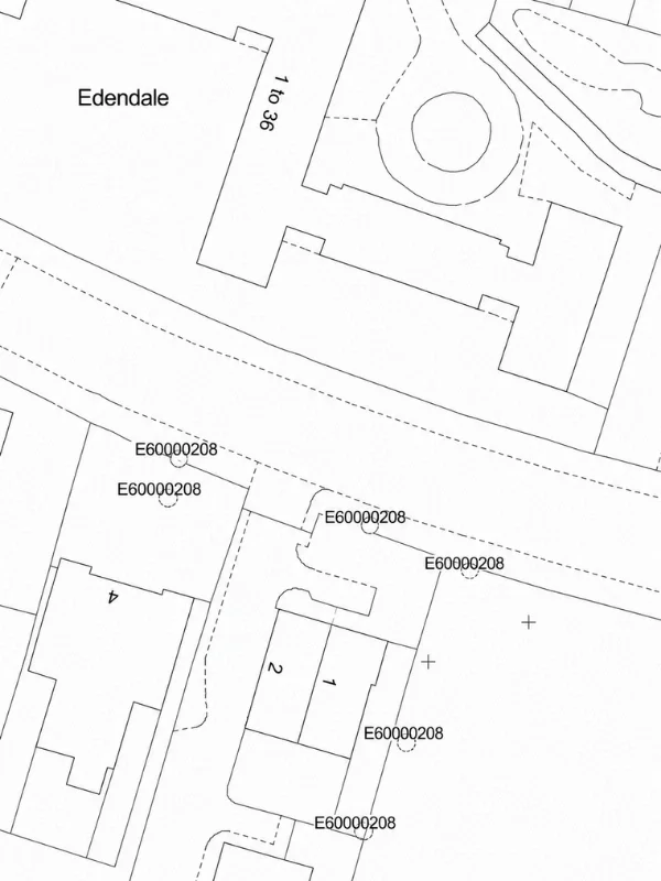
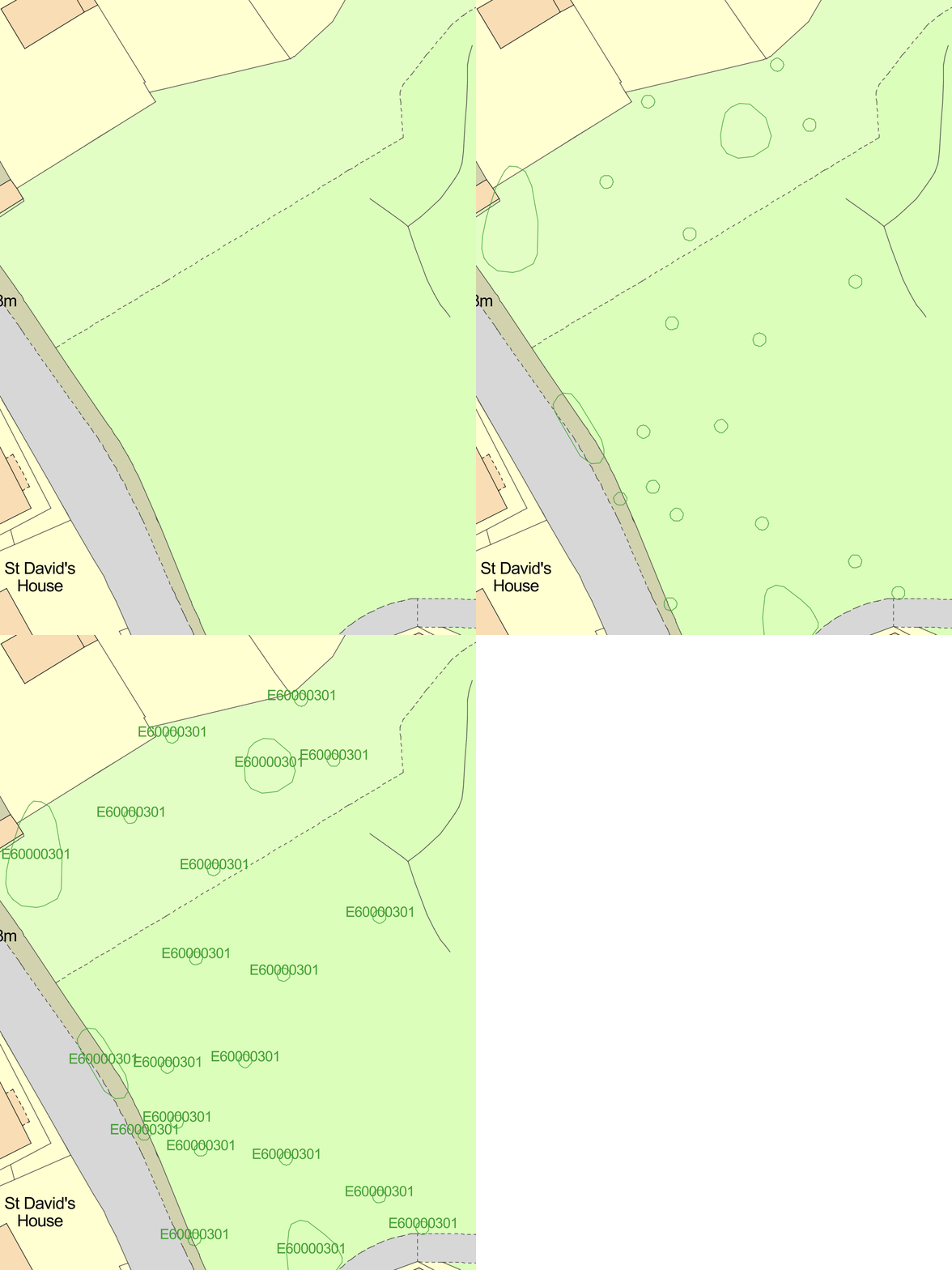
Tree Preservation Order mapping - identify protected trees and TPO constraints affecting development sites.
Planning and arboricultural support - useful for planning applications, site assessments and land analysis.
Protected tree and conservation context - understand tree-related planning constraints before development begins.
Site-specific TPO maps and overlays - suitable for planning, environmental and professional workflows.
Tree Preservation Orders (TPOs) are legal protections made by local planning authorities to protect specific trees, groups of trees or woodland from damage, removal or unauthorised works. TPOs are commonly used where trees contribute to local amenity, landscape character or environmental value.
Protected trees can affect planning applications, development proposals, access arrangements and site design. Understanding tree constraints early in the planning process can help avoid delays, redesign costs or potential planning issues.
Tree Preservation Order maps are widely used to:

| Sector | Need | Why it's used | Typical format |
|---|---|---|---|
| Planning | Identify protected trees affecting development | Helps assess planning constraints before submitting applications | CAD (DWG & DXF) |
| Architecture | Understand tree constraints during design | Supports layout planning and site design around protected trees | CAD (DWG & DXF) |
| Arboriculture | Assess protected tree locations and coverage | Assists arboricultural reports and tree impact assessments | CAD (DWG & DXF) |
| Development & Land | Evaluate planning and environmental constraints | Identifies tree protections that may affect site potential | CAD (DWG & DXF) |
| Surveying | Review site features and protected landscape elements | Supports site analysis and development feasibility work | CAD (DWG & DXF) |
| Environmental Consulting | Assess ecological and landscape considerations | Helps identify protected tree coverage within wider site constraints | CAD (DWG & DXF) |
| Map product | Best used for | Key limitations |
|---|---|---|
| Tree Preservation Orders (TPOs) | Identifying legally protected trees | Coverage and updates may vary by authority |
| Conservation area mapping | Understanding wider protected landscape areas | Does not identify all individually protected trees |
| Combined planning constraints | Early-stage planning and site analysis | Additional arboricultural assessment may still be required |
| Local authority tree data | Site-specific planning review | Availability differs between councils |
While Tree Preservation Order maps provide important planning context, they should not replace detailed arboricultural surveys or formal planning advice where protected trees may affect development proposals.
| Attribute | Description |
|---|---|
| Coverage | Great Britain |
| Data sources | Local authorities |
| Formats | CAD (DWG & DXF) |
| Mapping types | Protected trees, woodland and planning tree constraints |
| Projection | British National Grid |
| Grid reference system | OSGB36 |
| Mapping extent | Site-specific and surrounding planning context |
| Compatible workflows | Planning, arboricultural and environmental analysis |
| Output options | TPO overlays, planning constraint maps and site-specific extracts |
A Tree Preservation Order is a legal protection made by a local planning authority to protect specific trees, groups of trees or woodland from removal, damage or unauthorised works.
A TPO map shows the location of protected trees and tree-related planning constraints that may affect development, land use or planning applications.
Yes. Protected trees can affect site layout, access, construction works and planning decisions. Identifying TPO constraints early helps reduce planning risk and redesign costs.
Some protected tree mapping may also include conservation area context where relevant, although conservation areas and Tree Preservation Orders are separate planning constraints.
Works to protected trees usually require permission from the relevant local planning authority before pruning, removal or development activity takes place.
Coverage can vary between local authorities and datasets. Additional checks with the relevant planning authority may still be required for formal planning or legal purposes.
Yes. Tree Preservation Order mapping is commonly used by planners, arboricultural consultants, architects, surveyors and environmental professionals during site assessment and planning workflows.
No. TPO maps provide planning constraint information but do not replace detailed arboricultural surveys, tree condition assessments or ecological reports where required.


