If you're searching for a free property boundary map in the UK, you're not alone. Whether you're preparing a planning application, resolving a boundary dispute, or just trying to understand your land ownership, free mapping tools can seem like the perfect solution.
But here’s the reality: most free boundary maps are not suitable for planning or legal use.
This guide explains where to find free boundary maps, what they actually show, and when you’ll need a compliant alternative.
What Is a Property Boundary Map?
A property boundary map shows the extent of land ownership for a specific property. In the UK, these are typically based on:
- Ordnance Survey mapping
- HM Land Registry title plans
- GIS or CAD datasets
However, it’s crucial to understand that:
Land Registry boundaries are “general boundaries”
They indicate approximate positions—not exact legal lines.
Where Can You Get a Free Property Boundary Map?
1. HM Land Registry (Free Preview Tools)
You can view boundary outlines using Land Registry’s map search tools.
Pros:
- Official data source
- Easy to access
Cons:
- Low resolution
- Not to scale
- Not suitable for planning submission
2. Free Online Mapping Platforms
Platforms offering OS-based mapping previews can show property extents.
Pros:
- Quick access
- Useful for early-stage research
Cons:
- Often lack scale accuracy
- No PDF export for planning
- Missing annotations
3. Google Maps (Not Recommended)
While widely used, Google Maps is not suitable for boundary identification.
Why?
- No legal boundary data
- No scale compliance
- No planning acceptance
The Hidden Problem With Free Boundary Maps
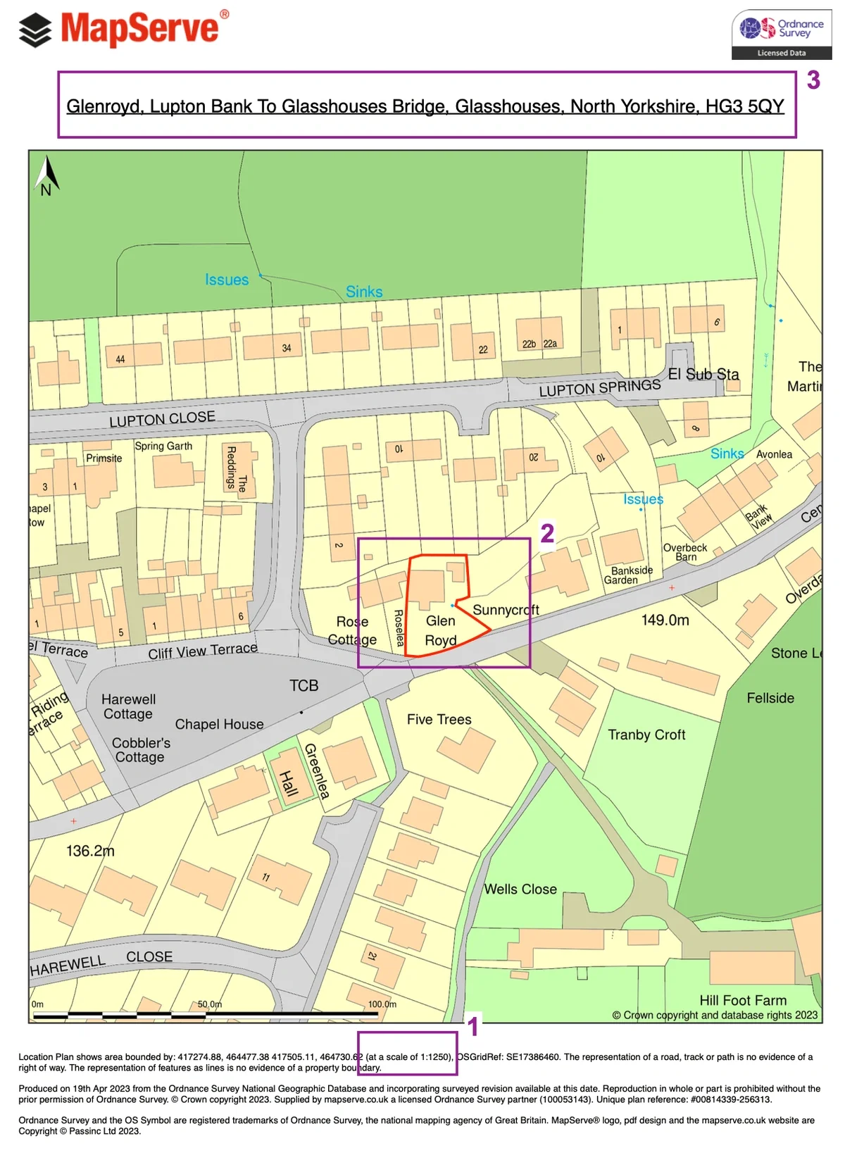
1. Scale Non-Compliance
Planning applications in the UK require:
- 1:1250 scale (urban)
- 1:2500 scale (rural)
Free maps rarely meet these standards.
2. Missing Red Line Boundary
A valid planning map must clearly show:
- Red line boundary (application site)
- Blue line (other land owned)
Free tools typically don’t allow compliant marking.
3. No Address or Site Context
Planning authorities require:
- Site address
- Surrounding roads and buildings
- Clear orientation
Free maps often lack this structured presentation.
When Is a Free Boundary Map Useful?
Free maps are still valuable for:
- Initial feasibility checks
- Understanding land extent
- Early design discussions
- Internal team communication
But they should not be used for submission.
When You Need a Professional Boundary Map
You’ll need a compliant map if you are:
- Submitting a planning application
- Preparing a lawful development certificate
- Supporting a boundary dispute
- Creating CAD site plans
What Makes a Compliant Boundary Map?
A valid planning boundary map must include:
- Correct OS base mapping
- Fixed scale (1:1250 or 1:2500)
- Red line boundary
- Clear site context
- PDF format suitable for submission
Why Professionals Avoid “Free” Maps
Architects and planning consultants typically avoid free tools because:
- They risk validation rejection
- They slow down workflows
- They require rework later
Instead, they use instant mapping platforms that generate compliant outputs in seconds.
The Smarter Alternative
Instead of relying on free tools, professionals use:
- Instant OS-based boundary maps
- Pre-scaled PDFs
- CAD-ready downloads (DWG/DXF)
This ensures:
- Faster approvals
- No validation issues
- Seamless CAD integration
FAQs
1. Are free property boundary maps accurate?
They are approximate, not legally precise.
2. Can I use a free map for planning permission?
No. Most councils will reject non-compliant maps.
3. What scale should a boundary map be?
Typically 1:1250 (urban) or 1:2500 (rural).
4. Is Land Registry boundary data exact?
No—it uses general boundaries, not fixed legal lines.
5. What’s the best alternative to free maps?
Use a service that provides planning-compliant OS maps instantly.