Free to view MasterMap®
Download in a few minutes
Save up to 40% vs. other suppliers
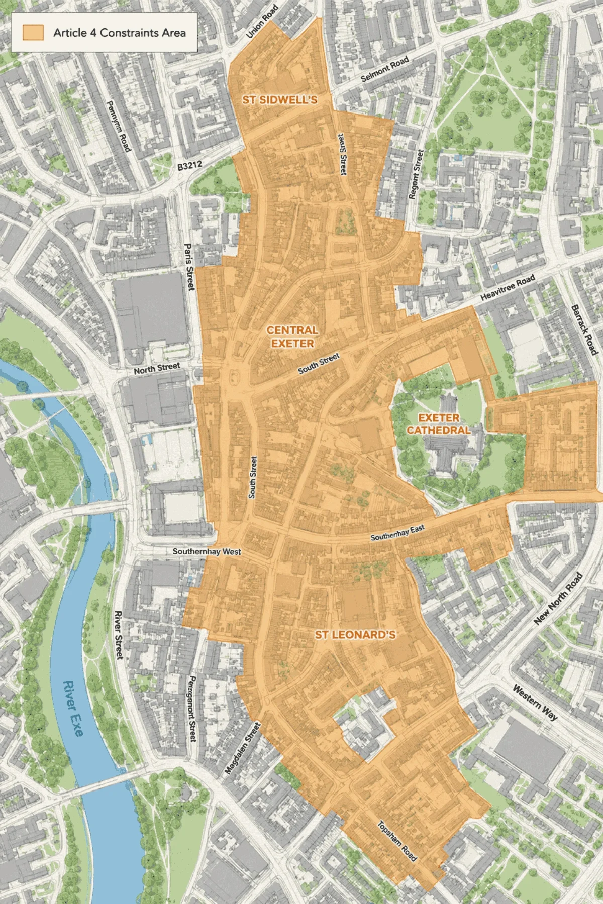
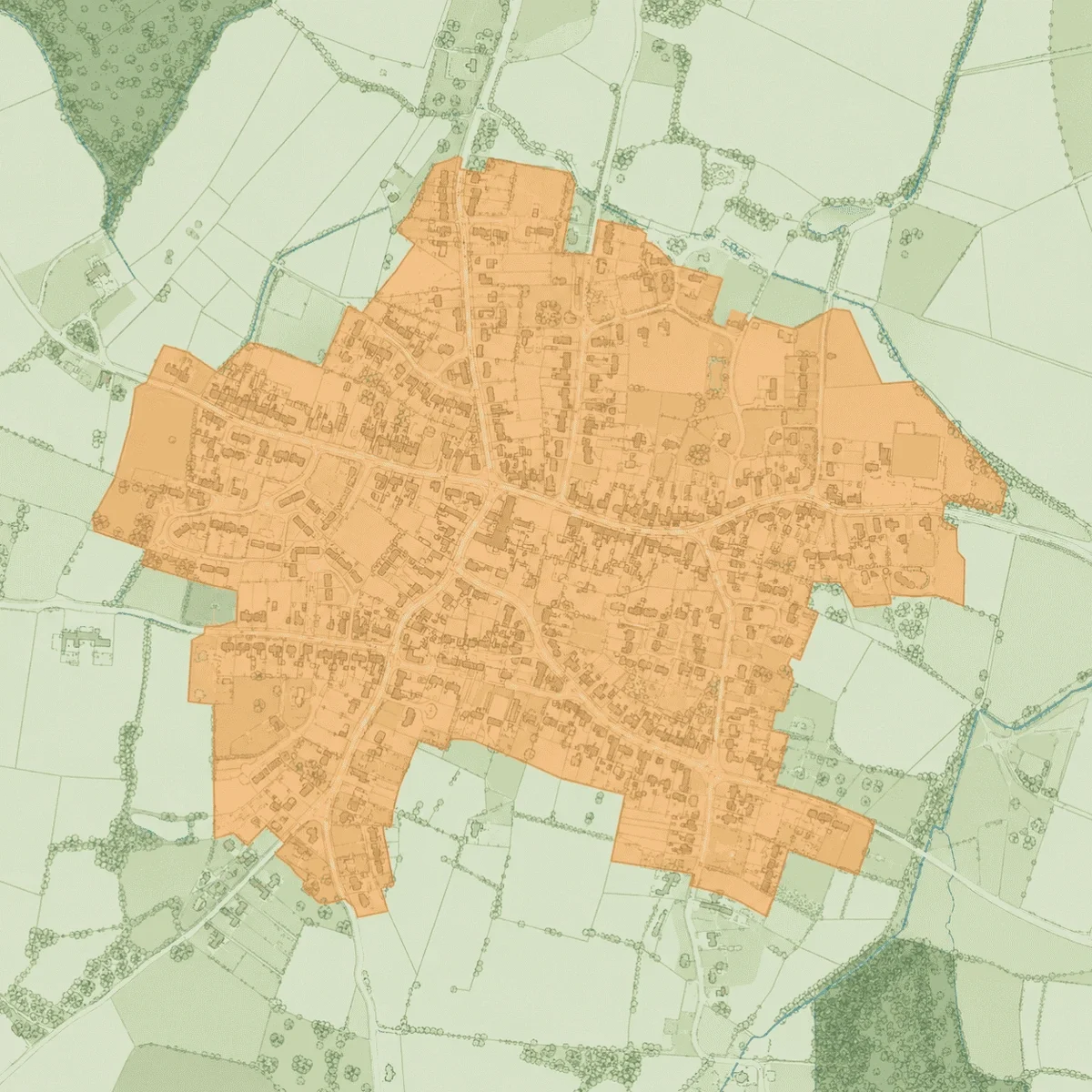
Article 4 Direction mapping - identify areas where permitted development rights have been restricted.
OS MasterMap® base mapping included - accurate building, boundary and site context.
Planning constraint mapping for development and property assessment workflows.
Site-specific Article 4 maps - understand planning restrictions before development begins.
Article 4 Directions are planning controls made by local planning authorities that remove specific permitted development rights. This means certain works that would normally not require planning permission may instead need formal approval.
Article 4 Directions are often used in conservation areas, town centres, residential neighbourhoods and areas where local authorities wish to manage changes to buildings, land use or character.
Article 4 maps are commonly used to:

| Sector | Need | Why it's used | Typical format |
|---|---|---|---|
| Planning | Identify planning restrictions | Helps assess whether permitted development rights apply | DWG, DXF |
| Architecture | Understand development constraints | Supports design strategy and planning submissions | DWG, DXF |
| Development & Land | Assess site potential | Identifies restrictions affecting development opportunities | DWG, DXF |
| Property | Investigate planning limitations | Helps understand restrictions affecting property alterations | DWG, DXF |
| Surveying | Review planning context | Supports site appraisals and feasibility studies | DWG, DXF |
| Planning Consultancy | Assess local planning controls | Assists planning advice and development assessments | DWG, DXF |
| Map product | Best used for | Key limitations |
|---|---|---|
| Article 4 Directions | Identifying permitted development restrictions | Does not include all planning constraints |
| Conservation Areas | Understanding heritage planning controls | Does not automatically indicate Article 4 restrictions |
| Listed Buildings | Identifying protected heritage assets | Different planning controls apply |
| Combined planning constraints | Early-stage planning and site assessment | May require specialist planning advice |
While Article 4 maps identify areas where permitted development rights may be restricted, they should not replace professional planning advice or formal planning enquiries.
| Attribute | Description |
|---|---|
| Coverage | England, Wales & Scotland |
| Data sources | Local authorities |
| Formats | CAD (DWG& DXF) |
| Mapping types | Article 4 Direction boundaries and planning constraints |
| Projection | British National Grid |
| Grid reference system | OSGB36 |
| Mapping extent | Site-specific and surrounding planning context |
| Base mapping | OS MasterMap® |
| Licensing | Subject to applicable planning dataset and Ordnance Survey licensing terms |
An Article 4 Direction is a planning control that removes specific permitted development rights, meaning planning permission may be required for works that would otherwise be permitted.
An Article 4 map shows areas where local planning authorities have introduced Article 4 Directions restricting permitted development rights.
They can affect extensions, alterations, changes of use and other development proposals that would normally not require planning permission.
They are commonly used in conservation areas, town centres and locations where local authorities want greater control over development.
No. It does not prevent development but may require planning permission where it would not otherwise be needed.
Yes. They can help identify planning restrictions affecting future development or alterations to a property.
Yes. Local authorities can introduce, amend or remove Article 4 Directions over time.
No. They provide planning context but should not replace professional planning advice or consultation with the local authority.


