Submitting a planning application in the UK requires accurate, licensed mapping derived from Ordnance Survey data.
Local authorities validate applications based on specific mapping requirements, including scale, clarity, and copyright compliance. Using the wrong map — or unlicensed mapping — can result in delays or rejection.
This guide explains exactly which maps are required and how to obtain compliant plans.
Quick Overview
Most UK planning applications require:
-
A Location Plan (usually 1:1250 or 1:2500 scale)
-
A Block Plan (typically 1:500 or 1:200 scale)
-
Mapping derived from licensed datasets such as MasterMap®
You can download compliant planning maps directly from MapServe®.
1. Location Plans
A location plan shows the site within its wider context.
It must:
-
Clearly outline the application boundary in red
-
Show surrounding roads and properties
-
Include a north point
-
Be drawn at a recognised scale
Standard Scales
1:1250
Used for urban and residential sites.
1:2500
Used for rural or larger sites.
These scales are derived from licensed Ordnance Survey datasets.
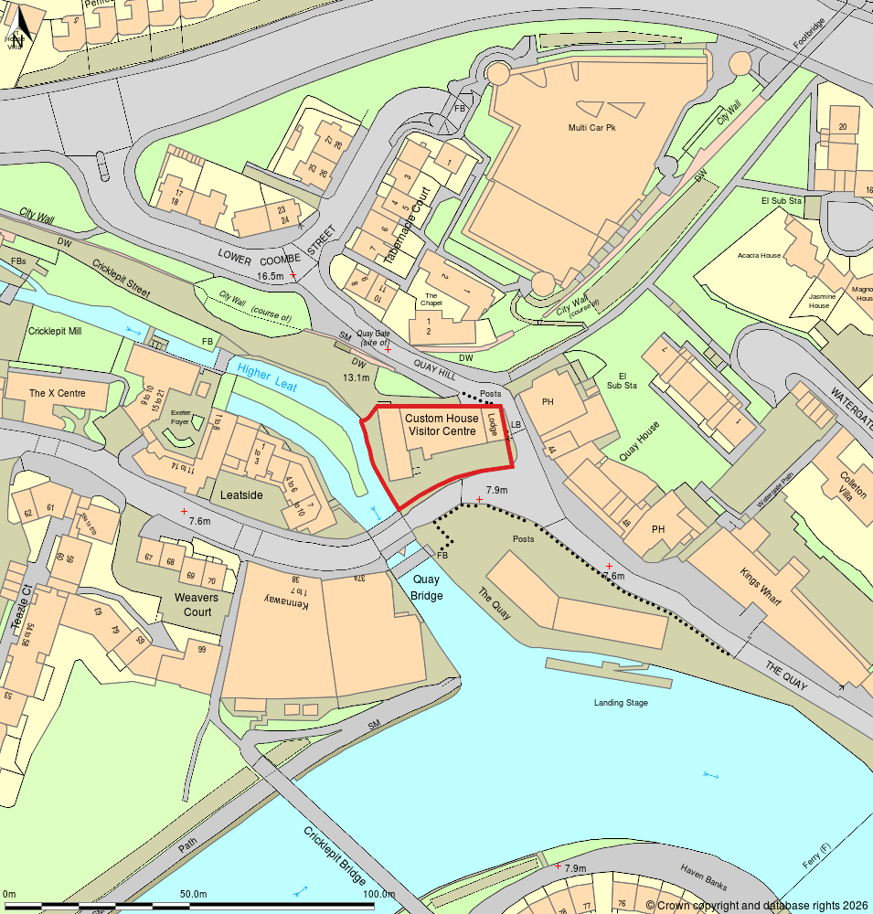
Example of a location plan
2. Block Plans
A block plan provides more detail of the immediate site area.
It typically shows:
-
Existing buildings
-
Proposed development
-
Site boundaries
-
Access points
-
Parking arrangements
Block plans are usually created using detailed base mapping from MasterMap®.
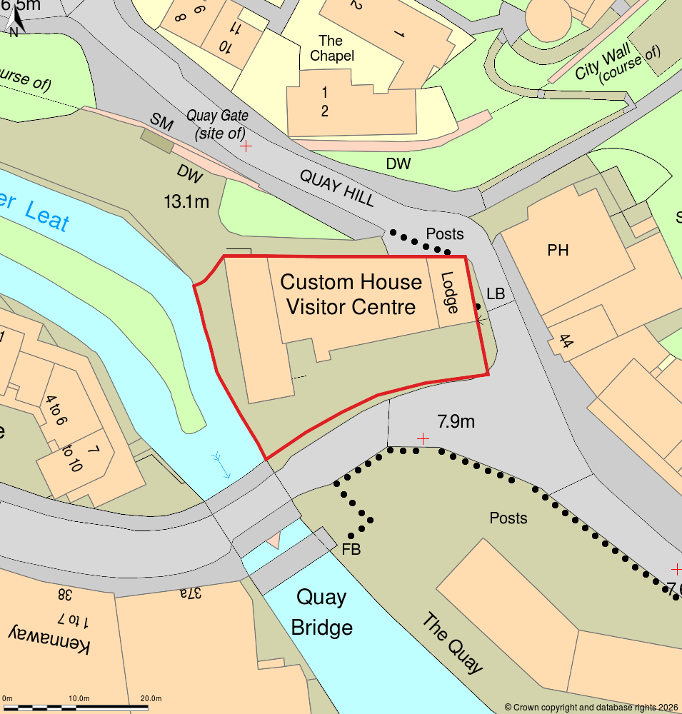
Example of a block plan
3. Why Licensed Mapping Is Required
Planning authorities expect mapping to:
-
Be based on licensed Ordnance Survey data
-
Include appropriate copyright statements
-
Be accurate and up to date
-
Be produced at recognised scales
Screenshots from consumer mapping platforms are not acceptable.
Professional planning maps must originate from authorised datasets.
4. Digital Formats for Planning Drawings
Planning maps are commonly supplied as:
-
PDF (for submission)
-
DWG or DXF (for architectural workflows)
If you are preparing drawings in CAD software, you may require OS mapping in DWG format.
5. Common Validation Issues
Applications are often delayed because:
-
The scale is incorrect
-
The red line boundary is unclear
-
The map is cropped incorrectly
-
Copyright notices are missing
-
Unlicensed mapping was used
Ensuring your maps are generated from licensed OS datasets avoids these problems.
6. When Is MasterMap® Needed?
For detailed planning submissions — particularly where precise building footprints or boundary detail are required — MasterMap® provides the most accurate base data.
It includes:
-
Detailed building outlines
-
Road layouts
-
Land parcel boundaries
-
Physical site features
Location and block plans are typically derived from this dataset.
7. Are Requirements the Same Across the UK?
Most councils require:
-
Location plan (1:1250 or 1:2500)
-
Block plan (1:500 or 1:200)
However, additional requirements may apply for:
-
Listed buildings
-
Conservation areas
-
Major developments
-
Agricultural land
Always consult the local authority validation checklist.
Frequently Asked Questions
What maps are required for a planning application?
Typically a location plan at 1:1250 or 1:2500 and a detailed block plan.
Can I use Google Maps for planning?
No. Planning applications require licensed Ordnance Survey-based mapping.
Is MasterMap® required?
MasterMap® is commonly used to generate compliant planning maps.
Where can I get compliant maps?
You can download licensed planning maps directly from MapServe®.
Conclusion
Maps for planning applications must be based on licensed Ordnance Survey data and produced at recognised scales such as 1:1250 or 1:2500.
To ensure compliance and avoid delays, obtain professional planning maps derived from MasterMap® directly from MapServe®.