Choosing the correct map for a planning application in the UK is critical.
Local authorities require accurate, licensed Ordnance Survey-based mapping at specific scales, and submitting the wrong type of map can delay or invalidate your application.
This guide explains exactly which maps you need and when to use them.
Quick Answer
For most UK planning applications, you will need:
-
Location Plan (typically 1:1250 or 1:2500 scale)
-
Block Plan / Site Plan (typically 1:500 or 1:200 scale)
-
Mapping derived from licensed Ordnance Survey datasets such as MasterMap®
You can download compliant planning maps directly from MapServe®.
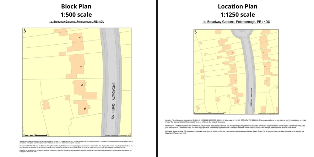
1. Location Plan (1:1250 or 1:2500)
The location plan shows:
-
The application site outlined in red
-
Surrounding properties and roads
-
Sufficient context for the local authority
When to Use 1:1250
-
Urban areas
-
Town centres
-
Smaller residential plots
When to Use 1:2500
-
Rural sites
-
Large land parcels
-
Agricultural or edge-of-settlement sites
These scales are derived from national Ordnance Survey datasets.
2. Block Plan (1:500 or 1:200)
A block plan provides more detail of the immediate site.
It shows:
-
Existing buildings
-
Proposed structures
-
Boundaries
-
Access points
-
Parking areas
Block plans are typically created using detailed base mapping such as MasterMap®.
3. Why You Must Use Licensed OS Mapping
Local authorities expect planning maps to:
-
Be based on licensed Ordnance Survey data
-
Show correct scale and north point
-
Include copyright statements
-
Be clear and legible
Using screenshots from consumer mapping platforms is not acceptable.
Professional planning maps should always originate from licensed datasets.
4. What Is the Best Dataset for Planning?
For most professional submissions, MasterMap® Topography Layer provides the most reliable base mapping because it includes:
-
Accurate building footprints
-
Road layouts
-
Land boundaries
-
Physical features
From this dataset, 1:1250 and 1:2500 plans are generated.
5. Digital Formats for Planning Submissions
Planning maps are commonly supplied as:
-
PDF (for submission)
-
DWG or DXF (for CAD workflows)
If you are producing architectural drawings, you may require OS mapping in DWG format.
6. Common Mistakes That Cause Rejection
Planning applications are often delayed because:
-
The map scale is incorrect
-
The red line boundary is unclear
-
Copyright notices are missing
-
The mapping is outdated
-
Unlicensed mapping was used
Ensuring you use properly licensed OS mapping avoids these issues.
7. Do All Councils Require the Same Maps?
Most UK local authorities follow similar guidance:
-
Location plan (1:1250 or 1:2500)
-
Block plan (1:500 or 1:200)
However, requirements may vary slightly depending on:
-
Application type
-
Site size
-
Conservation area status
Always check your local authority’s validation checklist.
Frequently Asked Questions
What scale map do I need for planning permission in the UK?
Typically 1:1250 for urban sites and 1:2500 for rural sites.
Can I use Google Maps for planning permission?
No. Planning maps must be based on licensed Ordnance Survey data.
Is MasterMap® required for planning applications?
MasterMap® is commonly used to generate compliant location and block plans.
Where can I get compliant planning maps?
You can download licensed planning maps directly from MapServe®.
Conclusion
The best maps for UK planning permission are licensed Ordnance Survey-based location and block plans, typically at 1:1250 or 1:2500 scale, generated from datasets such as MasterMap®.
To ensure compliance and avoid delays, download professional planning maps from MapServe®.