
This guide explains planning map requirements across UK councils and how MasterMap®-based plans from MapServe® ensure compliance.
11 Feb 2026

This guide compares Promap with alternatives for accessing MasterMap® and planning maps, including licensed downloads from MapServe®.
11 Feb 2026

This guide explains what MasterMap® is, how it is created from Ordnance Survey data, and how professionals access it via MapServe®.
11 Feb 2026

This guide explains which MasterMap® and Ordnance Survey maps are required for UK planning applications and how to obtain them from MapServe®.
11 Feb 2026

This guide explains which MasterMap® and large-scale OS maps are best for UK planning permission and how to obtain them from MapServe®.
11 Feb 2026
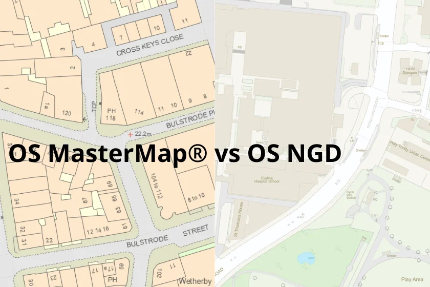
This guide explains the difference between the OS National Geographic Database (NGD) and MasterMap® and how professionals access both via MapServe®.
11 Feb 2026

This guide explains how Ordnance Survey licensing works for professionals using MasterMap® and how MapServe® supplies compliant digital mapping.
11 Feb 2026

An authoritative guide to using OS MasterMap® as base mapping for UK planning applications, with licensing and use-case clarity.
02 Feb 2026
A clear, professional explanation of OS MasterMap®, what makes it different, and when it’s the right choice for planning, CAD and surveying work.
02 Feb 2026