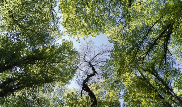
The preservation of green spaces has become a priority for cities all over the world in the ever-changing drive for sustainable urban growth. Trees, as steadfast protectors of nature's enchantment, play a critical role in preserving ecological balance and improving the overall well-being of urban communities. However, as cities develop in size and population, managing and preserving our precious trees becomes a tremendous challenge. The power of mapping has emerged as a significant instrument in this endeavour, revolutionising tree management and preservation practises.
Access the National Tree Map™ here
Understanding Tree Mapping
Tree mapping is a revolutionary technique that employs cutting-edge technology such as Geographic Information System (GIS) software and remote sensing to build full inventories of urban trees. Municipal authorities and environmentalists get significant insights about the distribution, species variety, health status, and environmental impact of trees in a given area by using GPS data and aerial images. On MapServe® we provide the National Tree Map™, an online database that gives extensive information on the location, height, and canopy extents of trees in England and Wales, with the goal of assisting individuals and groups in better understanding the distribution and features of trees throughout the country. The dataset consists of multiple layers including and not limited to he area of tree canopy, the last date the tree was surveyed, the maximum height of the tree and much more.
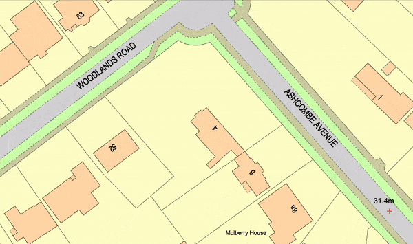
National Tree Map™ by MapServe®
Enhanced Tree Management
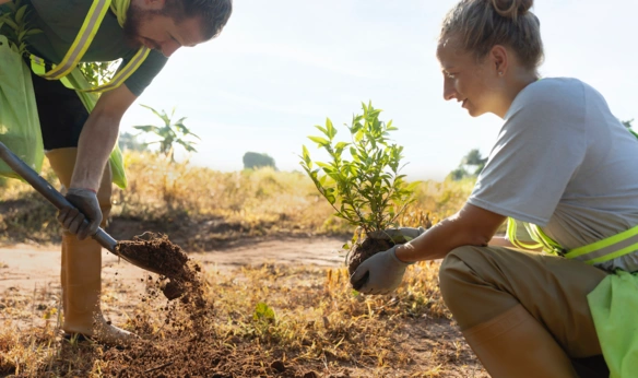
One of the most significant advantages of precise tree mapping is the effect it has on improved tree management practises. Cities can identify areas with high tree density and target locations where new plantations are most required by building detailed tree databases. This method of tree planting optimises resource allocation, simplifies tree upkeep, and promotes a healthier urban ecology.
Arborists and city planners may design individualised care plans for each tree using a variety of tree-specific data, taking into consideration elements such as species-specific requirements, age, and health state. This customised strategy ensures that trees receive the attention they require to thrive, resulting in healthier and more resilient urban forests.
Furthermore, tree mapping enables decision-makers to select the tree species used in project correctly, supporting the planting of native kinds that are well-adapted to local climates. Cities can boost resistance to environmental challenges and lessen the likelihood of widespread harm caused by invasive pests or diseases by diversifying their urban tree population.
A Sustainable Urban Development Vision
In a world where concrete cities are rapidly expanding, tree mapping provides a ray of hope for supporting sustainable urban development. City planners can design infrastructure projects that have the least impact on green spaces by correctly documenting the position and ecological significance of trees. This proactive approach to urban growth promotes a healthy coexistence between human expansion and nature, guaranteeing that city people can continue to benefit from trees' numerous benefits.
Developers can use mapping technologies to identify vital green corridors and protected zones where current trees should be conserved at all costs. These critical green spaces serve as wildlife sanctuaries, promoting biodiversity and providing much-needed relief from the rush and bustle of city life.
Cultivating a Sense of Ownership Through Community Engagement
The true potential of mapping technology is found not just in its ability to assist data collecting, but also in its ability to engage communities in the preservation of their natural areas. Residents can actively participate in tree preservation efforts thanks to user-friendly mapping software and community-driven initiatives. Citizens serve as the city's eyes and ears, reporting tree health issues and suggesting new tree planting areas.
This collaborative approach fosters a sense of ownership and common responsibility for the greenery of the city. Residents create a deeper connection with their surroundings and take pride in cultivating a greener and healthier urban environment when they feel like active participants in the preservation of their environment.
The value of trees in maintaining ecological balance and improving urban well-being cannot be emphasised in the face of urbanisation and environmental difficulties. Trees, as keepers of nature's importance deserve our undivided attention and care. The advent of mapping technology has ushered in a new era of tree management and preservation, enabling communities to make more informed decisions about tree care, optimise resource allocation, and promote sustainable urban growth.
Through tree mapping, city planners, arboriculturists, and people can collaborate to ensure that today's concrete jungles become tomorrow's green oasis. Mapping technology is altering tree management and preservation practises through data-driven insights, strategic planning, and community participation, paving the path for a greener and more vibrant future for urban landscapes across the globe.