What are 3D maps?
3D maps allow you to discover insights that typical two-dimensional (2D) maps cannot. 3D maps can help you to plot geographic and temporal data on a 3D custom map and create visual tours that you can share with potential customers and colleagues. They provide a more complete picture of space and demonstrate how features relate to others in their environment, allowing for greater accuracy in sizes, heights, and distances. For example, 3D tells a user right away if a block is a bungalow or a skyscraper, which can make a big difference in research and planning. They also provide comprehensive perspectives of the surroundings that a 2D view cannot provide, such as obstructions, buildings, or mountains.
Download 3D MasterMap® here
3D maps can help architects save money and time in several ways, including:
- Reduced design errors: 3D maps allow architects to visualise and test different design options before construction begins, reducing the risk of design errors and the need for costly revisions.
- Better collaboration: architects can collaborate more effectively with engineers, contractors, and other stakeholders, reducing the risk of miscommunication and the need for costly changes during construction.
- Improved construction planning: they can be used to create detailed construction plans and schedules, ensuring that the project stays on track and within budget.
- Enhanced presentations: 3D maps can be used to create compelling presentations for clients and stakeholders, reducing the time and effort needed to secure approval for the project.
- Streamlined facility management: by integrating 3D maps with Building Information Modelling (BIM) software, architects can provide a comprehensive and accurate representation of a building and its components. This can be used for facility management, reducing the need for physical inspections and reducing the time and effort needed to maintain the building.
- Better cost estimation: they can also be used to accurately estimate construction costs and materials, reducing the risk of cost overruns and helping to ensure that the project stays within budget.
- Faster construction: 3D maps can be used to streamline the construction process, reducing the time and effort needed to complete the project and allowing architects to get their buildings up and running more quickly.
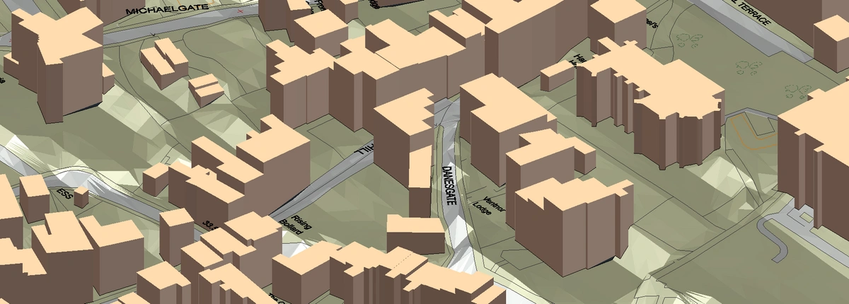
3D MasterMap® sample
How is 3D MasterMap® useful for an architect?
3D MasterMap® comprises 3D buildings superimposed over the OS Terrain 5 Digital Terrain Model to provide a full 3D image of a site's natural and manmade terrain. It provides highly detailed and accurate information about the physical features of an area, including height information about buildings, roads, and topographic features. This information can be used to make informed decisions about site selection, building design, and construction planning, which can help to avoid costly mistakes and rework later on in the project.
For example, it can help architects to identify potential design constraints, such as physical obstacles or the proximity of adjacent buildings, which can impact the design of a building. This information can be used to make design decisions that take these constraints into account, which can help to minimise the risk of costly changes or delays during construction.
Additionally, 3D MasterMap® can be used to create detailed virtual models of a building and its surrounding environment and building massing studies, which can be used to visualize the final product and make any necessary design changes before construction begins. This can help to avoid costly rework and minimize the risk of construction errors, which can save time and money in the long run.
Overall, it is a valuable tool for architects, as it provides accurate and up-to-date information about the physical features of an area, which can be used to make informed decisions and minimize the risk of costly mistakes during the design and construction phases of a project.
Click on the following two links to see how two of our clients saved over £1500 and several weeks of project time using our 3D MasterMap®:
1. Atelier Two Architecture - Use Case
2. Aubrey Architects - Use Case
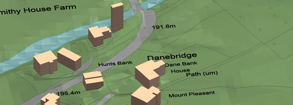
3D MasterMap® sample