Architects use 3D maps for a variety of applications. They must be familiar with the spatial context of development in order to create a good project. In 2020, after the RIBA Plan of Work was modified the new Stage 3 "Spatial Coordination" replaces "Developed Design" and establishes a firm deadline for architects to consider the larger context of their proposal. However, obtaining site information is a work of Stage 1, and Site Survey and 3D models of the built environment are frequently employed in Stage 0 for the initial Site Assessment.
Depending on the project, most architects typically use existing 3D area or city maps or create their own 3D model of a city region to do this. '3D model' refers to a broad category that includes everything from simple extruded map polygon representations to custom-made millimetre-accuracy 3D scans. 3D city maps differ widely in terms of price, delivery time, and file format, as well as accuracy, level of detail, recency, and usefulness.
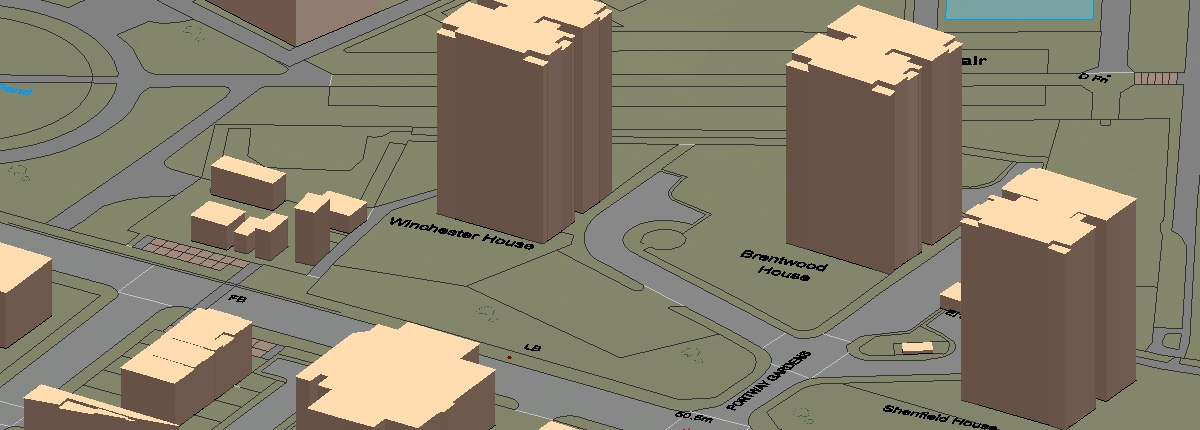
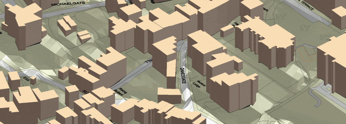
Our 3D MasterMap® consists of 3D buildings placed on the Ordnance Survey's Terrain 5 Digital Terrain Model to create a complete 3D depiction of a site's natural and artificial topography. It gives very detailed and accurate information on an area's physical features, including building height information, water features, roads and topographic information.
What can architects use 3D maps for?
Download 3D MasterMap® here
1. Provide true representations of the earth: Digital 3D map models reflect every component of the earth. With the addition of capabilities such as fly-throughs and 3D rotation in space, architects have a complete model to explore and use to communicate ideas and design concepts, as well as comprehend the ramifications of each modification on the land as a whole.
2. Check and revise design ideas: Architects and designers can work directly with clients and customers on the design and layout of a project, whether it's a residential or commercial project of a larger scale. This way they can achieve maximum efficiency and the best return on investment, by testing and updating how the land is going to change.
3. Construction planning: They can also be used to create detailed construction plans and schedules to ensure that a project stays on track and within budget.
4. Carry out spatial analysis: Spatial analysis provides architects with a comprehensive understanding of the project area, including how it performs, interacts with its surroundings, and how people can move through and use it. This allows architects to fine-tune every aspect to make the project more efficient, cost-effective, and sustainable in everything from energy use to traffic flow.
5. BIM(Building Information Modeling): 3D mapping can be integrated with Building Information Modeling (BIM) software to create a virtual representation of a building and its components. This can be used for design, construction and facility management throughout the building's life cycle.
6. Display design concepts in a captivating manner: It's one thing to describe an idea or concept to a client with words or drawings; it's quite another to be able to show them in immersive 3D how it would appear in reality. Architects are known for pushing boundaries and bringing often amazing thoughts to life, which can be difficult to accept if you are not familiar with their vision but are bearing the cost. They can illustrate the what, how, and why to their clients using digital 3D models, verifying concepts, and changing future skylines with newer architecture. 3D maps can provide the base for these design concepts to come to life.
7. Market and sell a project, prior to construction: Just because a project hasn't been built shouldn't prevent it from being efficiently marketed and sold; in fact, getting investors on board is frequently a vital first step in making a project profitable. With a completely functional and detailed digital 3D model, it is much easier to help clients, consumers, and investors understand the concept and see exactly where their investment is going or what they are purchasing. These can be used in everything from TV and online ads to promotional materials and presentations, as well as at events and fairs. 3D maps can help make a 3D model of a large project quickly and accurately.
8. Building massing studies: Architects can visually identify the various spatial requirements in the brief and compare them to the existing surrounding or on site buildings, as well as the relationship between the locations, buildings and various features of the site.
9. Environmental analysis: 3D maps can be used to analyse and visualise urbanisation, deforestation and building evolution of small or large areas which can help develop a project with environmental consciousness.
10. Shadow analysis: They can also help a designer research the amount of solar access to various portions of the site and building design at different times of the day. Public spaces, communal amenity areas, traditional and arterial main streets, and residential private outdoor amenity areas are examples of areas that can be studied using 3D mapping in order to create a shadow analysis.
You can download a sample of our 3D MasterMap® here.
Click on the following two links to see how two of our clients saved over £1500 and several weeks of project time using our 3D MasterMap®:
Contact Atelier Two Architecture here.
Contact Aubrey Architects here.