What is the Ordnance Survey (OS)?

Get detailed Ordnance Survey maps here
The Ordnance Survey (OS) is the United Kingdom's mapping agency. It conducts official surveys in the United Kingdom, giving the most precise and up-to-date geographic data on which the government, businesses, and individuals rely. It is a public corporation by the Department for Business, Energy & Industrial Strategy. They've created a variety of maps over the years, catering to the military, walkers, the government, cyclists, and road users and the building industry.
What does an OS map look like?
Physical and human aspects are represented as symbols on OS maps to improve the readability of the maps. Each OS map has a key that explains what the symbols indicate. You can find a guide to OS map symbols here.
The maps are covered with a grid of faint blue lines that are accompanied by numbers that allow you to properly pinpoint your location on a map. An Ordnance Survey map always has north at the top. The maps are available in a variety of scales. Individual towns and cities are generally depicted on large-scale maps like 1:1,250, 1:2,500, and 1:10,000. OS MasterMap®, which is the Ordnance Survey's flagship digital product, is considered a large-scale map. Small-scale maps, such as 1:25,000, 1:50,000, and 1:100,000, show smaller features and frequently trace greater areas or regions.
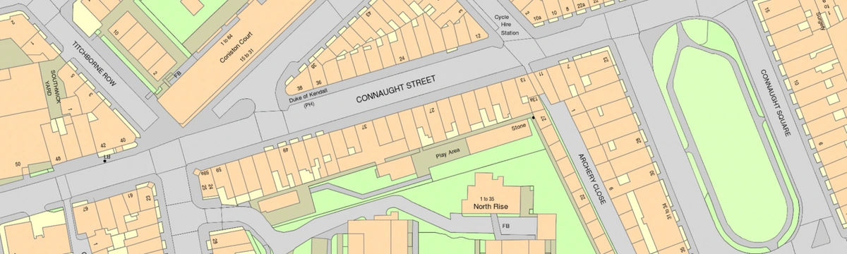
OS MasterMap® sample
How do I read an OS map?
Maps have symbols to represent where individual features are rather than descriptions. Symbols are employed to avoid covering maps in writing, which would be exceedingly confusing. The Ordnance Survey represents all of the roads, buildings, rivers, and other aspects of a landscape using various shapes, colours, and symbols. Symbols are intended to be simple, frequently resembling the characteristics they symbolise.
The maps are covered in a grid made up of faint blue lines. The lines are accompanied by numbers that allow you to properly pinpoint your location on a map. Once you've determined your location, the grid system makes it straightforward to provide others with a precise description of your location. The lines across the bottom of the map are known as eastings because they travel eastward. Northings are the lines that run up the side of the map and travel towards the north.
Grid references are classified into two types:
• 4-figure - such as 1287, this identifies a one-kilometre area on an OS map.
• 6-figure - for example, 589725 on an OS map identifies a 100-metre square within a single kilometre square.
The Grid reference is always for the grid square's bottom left-hand corner.
In addition to grid references, OS maps include a two-letter prefix to numbered grid lines. On OS maps, the two-letter prefixes are displayed in faint blue caps. The entire United Kingdom is divided into 100km squares, and each square is assigned two letters.
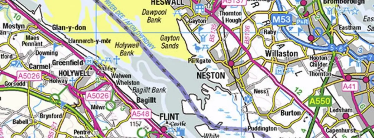
Typical OS map sample
What can an OS map be used for?
- Management and monitoring of land and property
- Architectural drawings
- Geographical analysis
- Route planning
- Walking, cycling and other recreational uses
- Military purposes
- Government data analysis
- Tourism
- Risk assessment
- Geographic representation of areas in the UK
- Property development
- Legal disputes
Stay updated with Ordnance Survey's latest developments and updates by checking out their "What's New" page on their official website.