In this blog post, we'll walk you through the simple process of obtaining detailed Ordnance Survey maps. Whether you're planning a project or just for personal use, we'll break down the steps to make ordering large-scale OS mapping easy and accessible.
Download large scale Ordnance Survey maps here
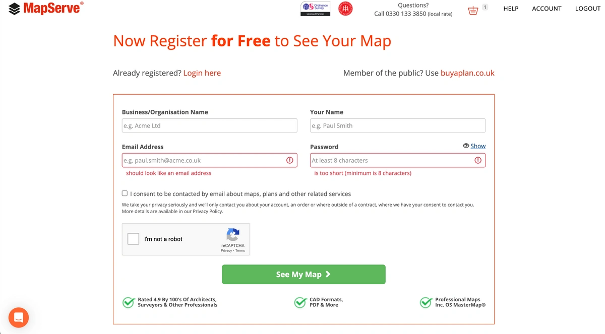
1. If you have an existing account with us, please log in using your provided personal information. If not you can register for a new account here as shown on the image below.
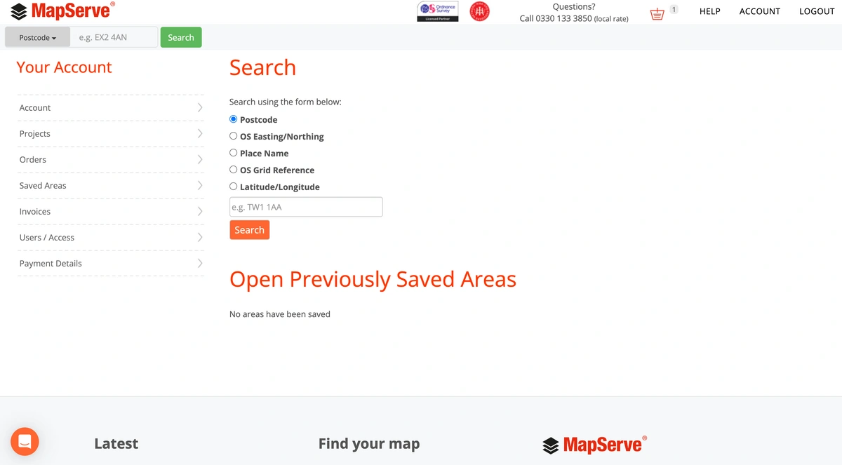
2. The first step is to search for the location that you want using either your:
- Postcode
- OS Easting/Northing
- Place Name
- OS Grid Reference
- Latitude/Longitude
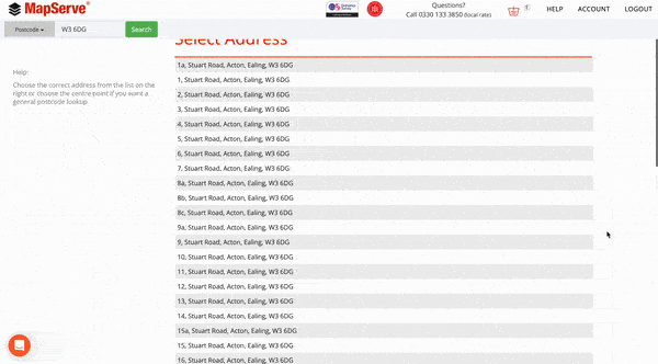
3. A menu displaying various available addresses will be visible. Select your address from the list as indicated below or choose the postcode as the central point for the map.
4. The map will automatically centre on the address you've chosen from the list.
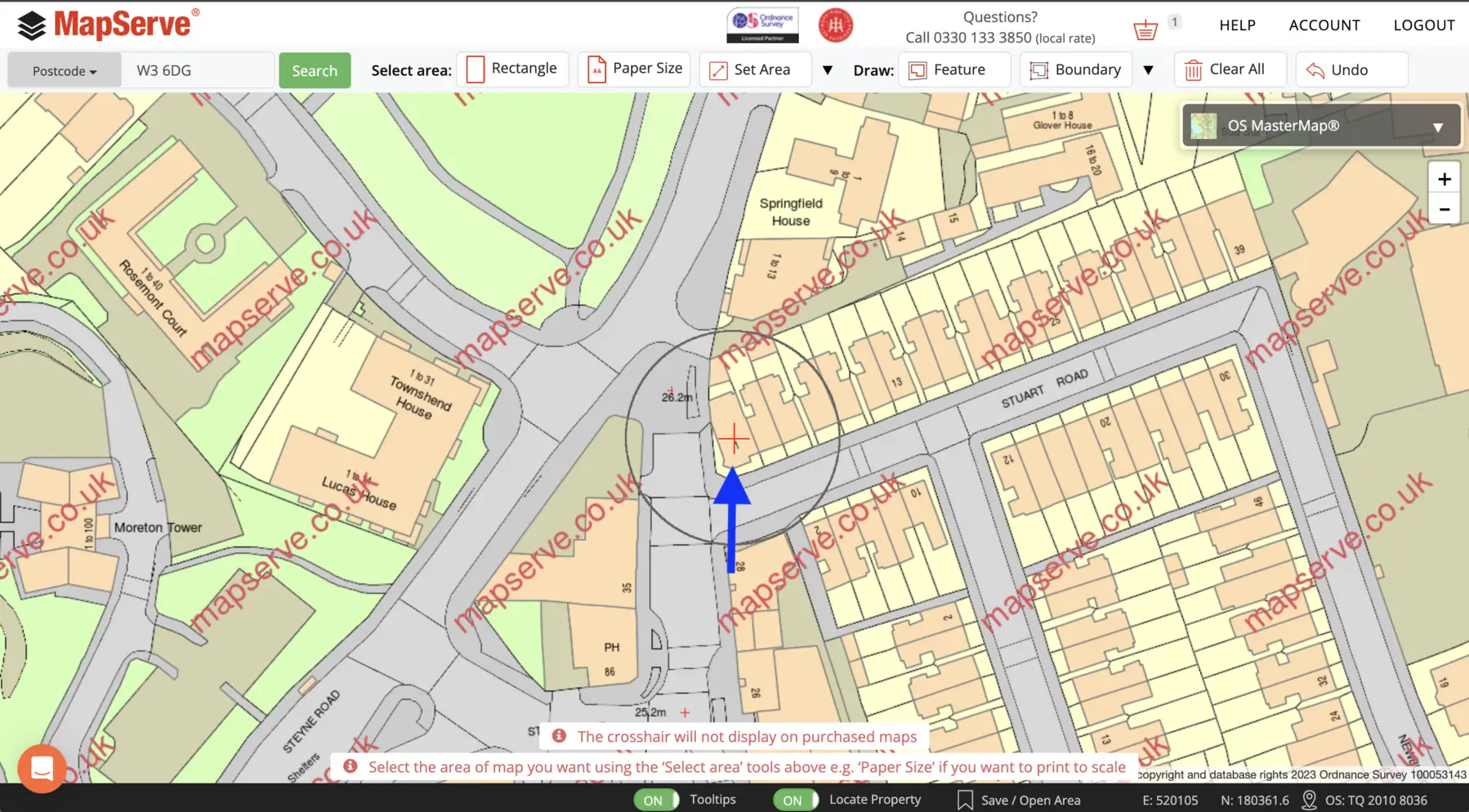
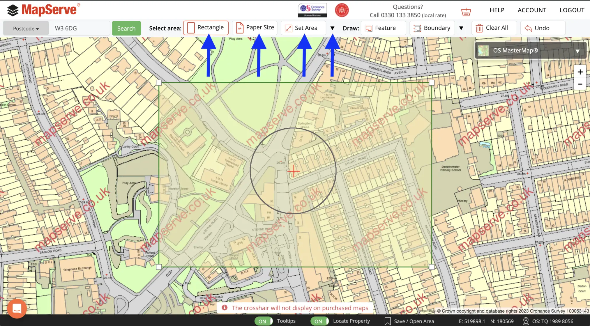
5. The next step is to outline the area using one of our selection tools. For PDF format the best option is the 'papersize' tool. For the rest of the maps you can use any other tool such as the 'rectangle, 'set area' or polygon tools.
6. All available maps will be displayed as a list on the left. You can check the OS maps that are available through MapServe® here.
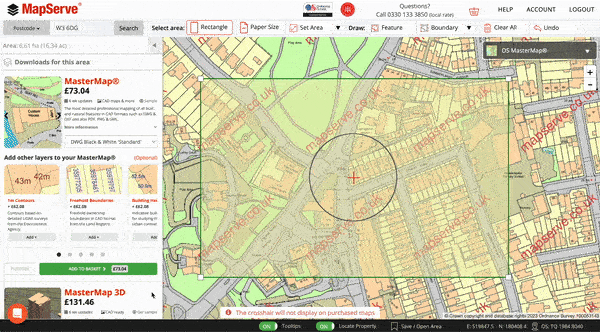
7. After you have selected and previewed the map that you need to purchase you need to click the 'ADD TO BASKET' button. You need to make sure that what you have added in your basket is the correct map and map format before you checkout.
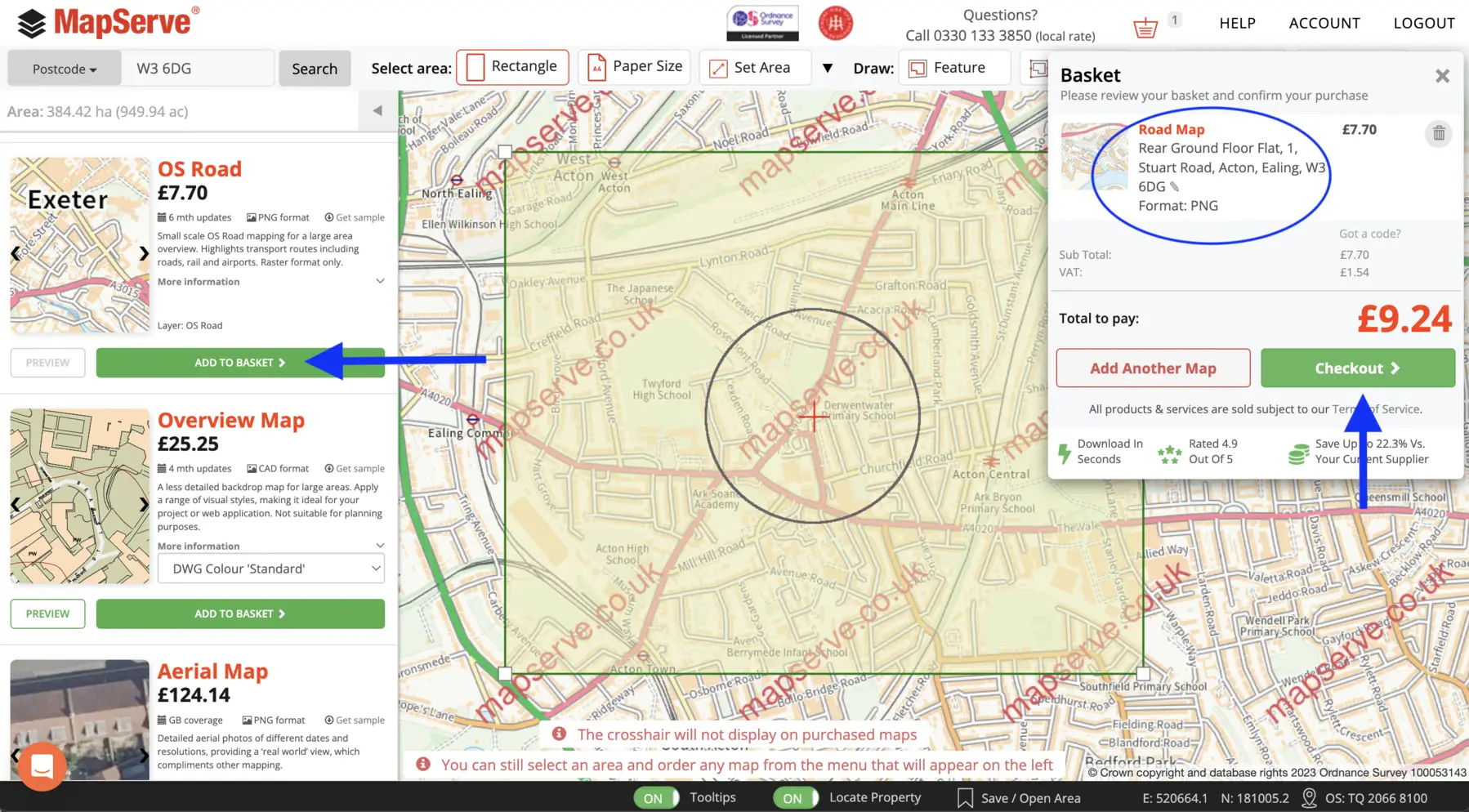
8. After you checkout the map will be available to download immediately. You can access all previous purchases through your account (top right of the screen).
