A list of all Ordnance Survey Maps available on MapServe®. You need to register or login for an account first and then look for the area that you want on our website.
Download the latest OS maps here
OS MasterMap®
The largest, most detailed and updated database in the United Kingdom that records every fixed feature in Great Britain greater than a few metres in a single continuous digital map. it is constantly reviewed and updated by the Ordnance Survey on a regular basis.
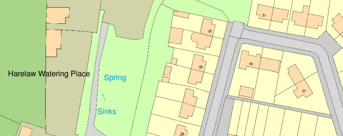
Contains: Buildings, roads, tracks, walkways, railroads, rivers, lakes, ponds, constructions, land parcels and much more
Coverage: the UK (Great Britain is available on our website)
Update: every 2 weeks
Format: PDF, PNG, DWG, DXF, GML
Read more about OS MasterMap® here.
OS MasterMap® 3D
OS MasterMap® 3D provides an excellent 3D depiction of buildings and landscapes, making it perfect for preliminary site evaluation, building massing studies, and shadow analysis, amongst other applications.
It incorporates the topography layer, building height data, and OS Terrain 5 terrain height data into a single file, saving time and money compared to constructing such a model from scratch.
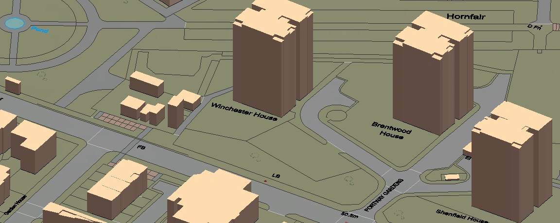
Contains: Buildings, roads, tracks, walkways, railroads, rivers, lakes, ponds, constructions, land parcels, building heights and much more
Coverage: the UK (Great Britain is available on our website)
Update: Base map - every 2 weeks
Building heights - quarterly (January, April, July, October)
Format: DWG, DXF
Software compatibility: AutoCAD
Read more about OS MasterMap® 3D here.
OS Overview Map
OS Overview Map (or VectorMap® Local has a variety of rich, detailed mapping characteristics and elements that enhance context data and in-depth analysis, compared to other similar data sources. The vector format of the map includes prebuilt colour selections. VectorMap® Local is automatically created from the OS Large Scale Topographic database (used for OSMM Topo), enhancing credibility and reliability to provide accurate and dependable real-world geospatial data. It is a backdrop map to OS MasterMap® which provides less detail but it is great for larger areas.
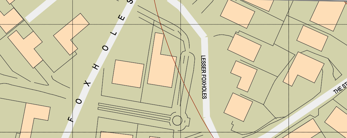
Contains roads, railways, vegetation, boundaries, urban extents, buildings, fences and water information.
Coverage: Great Britain
Update: Every quarter (January, April, July, October)
Format: DWG, DXF
OS Road Map
Highlights transportation routes such as highways, trains, and airports. It includes both local and major roads. Private roads and shorter cul-de-sacs are the only ones not depicted. It is only available in raster.
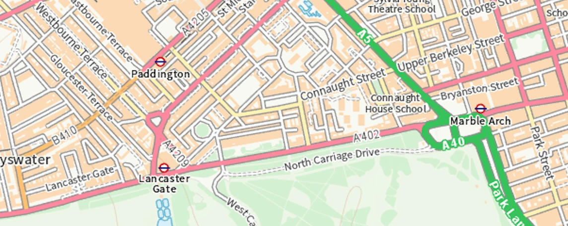
Contains: Motorways, A-roads, B-roads, road names, primary route information, motorways
Coverage: Great Britan
Update: Twice a year (April, November)
Format: PNG