OS MasterMap® is a comprehensive mapping database that contains a large number of different layers of information. It is created by the Ordnance Survey, the national mapping agency for the United Kingdom and it is one of the most comprehensive and detailed mapping databases in the world, covering all of Great Britain at a scale of 1:1250.
The exact number of layers of OS MasterMap® can vary depending on the specific version and release, but there are typically several hundred different layers of information available.
The exact number of layers can also depend on the specific application or use case. For example, some users may only need access to a subset of the available layers, while others may need access to the entire set of layers in order to perform more detailed analysis and mapping.
Regardless of the specific use case, OS MasterMap® is designed to provide a wide range of users with the information they need to make informed decisions about the physical features of Great Britain. Some of the users include government agencies, architects, surveyors, environmental agencies, tree specialists, various businesses, and individuals, that require accurate and up-to-date information about the United Kingdom's topography. The map is constantly updated with new information, so the number of available layers is subject to change over time.
Download the latest update of OS MasterMap® here
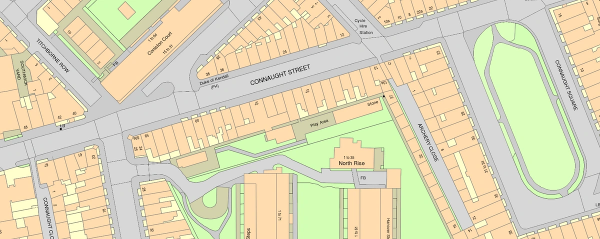
OS MasterMap® sample
OS MasterMap® contains several key layers of information, each of which provides specific data about the landscape of Great Britain. Some of the key layers of OS MasterMap® include:
Topography Layer: This layer provides detailed information about the physical features of the landscape, including roads, buildings, and topographic features such as hills, valleys, and rivers. It also contains administrative boundaries. As of June 2009, it included over 425 million features, making it the most detailed layer.
Integrated Transport Network: Information about the road networks and public transport services in Great Britain, including details about road and rail networks, ferry routes, and airport locations.
These are just a few of the key layers of information available in OS MasterMap®. The map is constantly updated with new information and new layers are added over time, making it an increasingly valuable resource for users who need accurate and up-to-date information about the physical features of Great Britain. All information about OS MasterMap® can be found here.
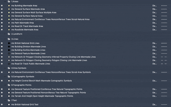
OS MasterMap® layers