What is a Design and Access Statement (DAS)?
A design and access (DAS) statement is a short report that accompanies and supports a planning application. It helps an applicant to explain how a proposed development is a suitable response to a specific site and its setting and demonstrates that it can be adequately accessed by future users. In a few words, it explains the design thinking behind a planning application. Although it is not a formal part of the planning application, the Statement must accompany the application and will be used by the third parties, the external consultants and the Council to understand and assess the proposal and to reach a decision on the application. It will be scanned onto the Council’s website and made available for public viewing. If it is not included, the application will not be registered. The intentions and promises made in the Statement will normally be tied into any permission granted, by the imposition of conditions and/or legal agreement.
Download professional mapping for your property here


Large scale developments need a Design and Access Statement (DAS)
When is a Design and Access Statement (DAS) required?
A Design and Access Statement should be prepared at the start of the development process and should be updated as the scheme is defined. The Statement is required to explain and justify the decisions made on the proposal and therefore it should not be written at the end as an afterthought. Early drafts are useful to assist pre-application discussions and design decisions.
The requirement for design and access statements applies to all applications for listed building consent. It also applies to all applications for planning permission except:
- a material change of use of land and buildings, (unless it also involves operational development)
- applications for approval of reserved matters and assessment of reserved matters applications)
- engineering or mining operations
- development of an existing dwelling house, or development within the curtilage of a dwelling house for any purpose incidental to the enjoyment of the dwelling house, where no part of that dwelling, house or curtilage is within a conservation area
- advertisements
- storage of hazardous waste
Since June 2013, a Design and Access Statement is only required if your building or premises has a Gross Internal Area of over 1,000m2. For a development of 9 units or less, the project does not need one. For 10 units or more, or if there is a listed building in a conservation area, as well as a Heritage Statement you would need a Design and Access Statement for listed building consent. Preparing a well-thought-out Design and Access Statement is very important for architects looking to improve their chances of gaining planning permission.


Conservation areas protect the character of the town centre or the town's High Street In central London, several boroughs are conserved
What should a Design and Access Statement (DAS) include?
The Design and Access Statement is usually a single document reflecting an integrated approach to the project. It should be concise but should cover all the necessary points. The level of detail included in the Statement will depend on the scale and complexity of the proposal. For example, a major housing scheme may need a long Statement of many pages long that explains the full design thinking, consultations undertaken, public involvement, options considered, and the justification for the design proposed. All Statements should include a written description and justification of the planning application, supported where appropriate by photos, maps and drawings.
Use of the proposed development:
- Proposed use/uses
- Distribution across the site
- Accessibility to the development or between them if it is more than one
- The development's relationship to uses surrounding the site.
Access to the development:
- Access to surrounding buildings, spaces and transport links
- Flexibility to changing needs of the development and the area
- Access for emergency services
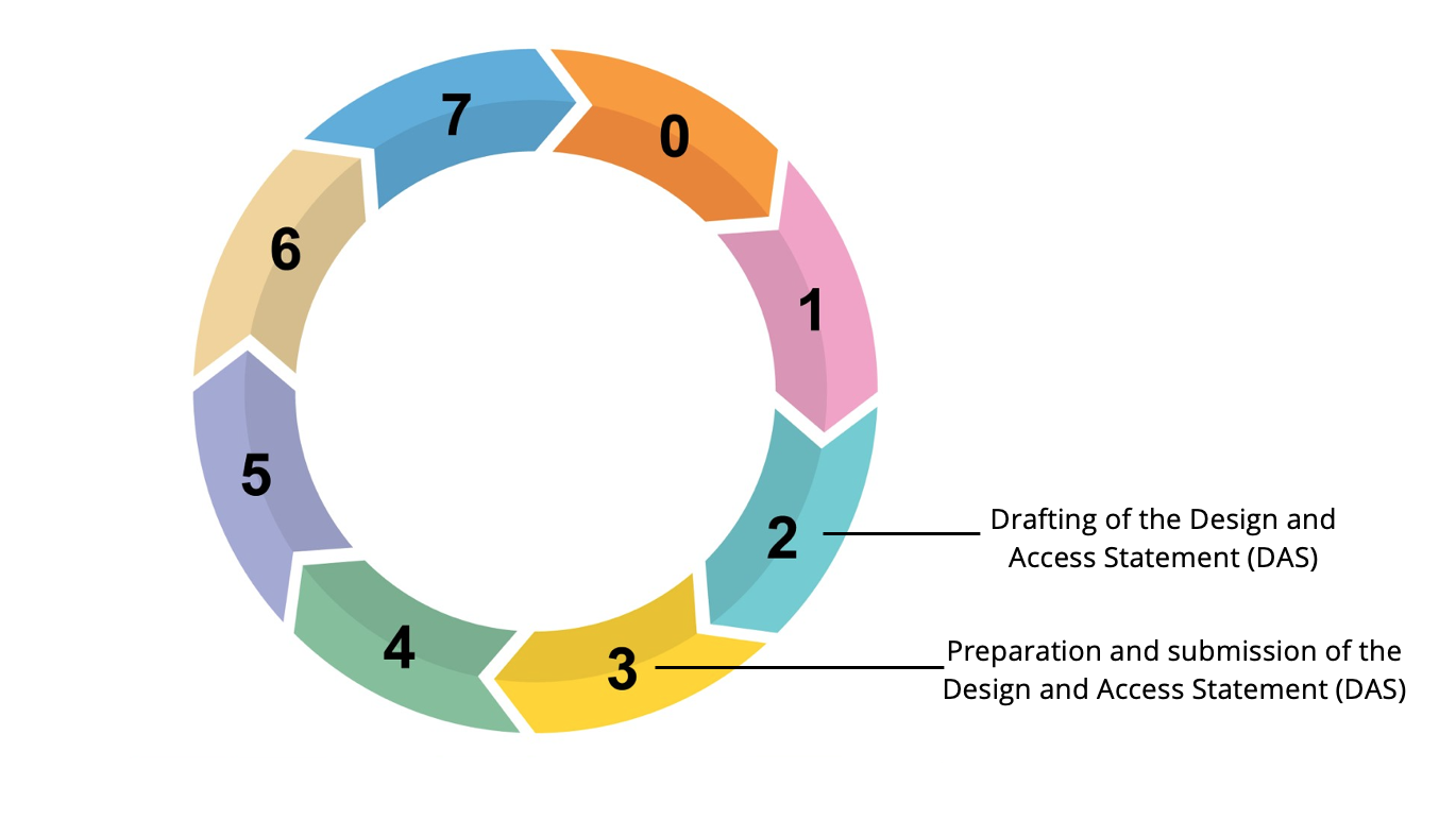
When is the Design and Access Statement (DAS) prepared and submitted?
A Design and Access Statement is drafted at the beginning of stage 2 of the RIBA Plan of Works, when required and assess possible developer contributions (section 106 of the Town and Country Planning Act of 1990) along with highway contributions and the Community Infrastructure Levy (CIS) requirements. They are finalised and submitted as part of the Planning Application at the end of Stage 3. A Design and Access Statement should be prepared at the start of the development process and should evolve as the scheme is defined. The Statement is required to explain and justify the decisions made on the proposal and therefore it should not be written at the end as an afterthought. Early drafts will be useful to assist pre-application discussion, which the Borough Council encourages.
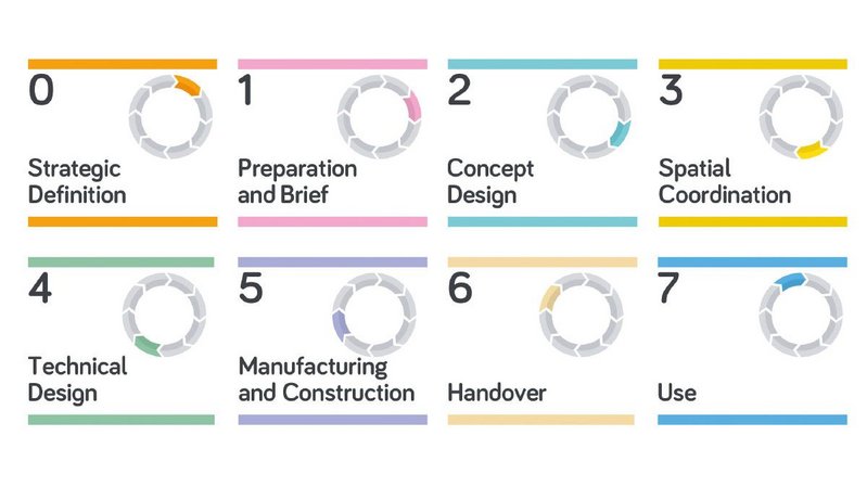
Stages where the Design and Access Statement is prepared and delivered / RIBA Plan of Work 2020
How mapping can be used in a Design and Access Statement (DAS)?
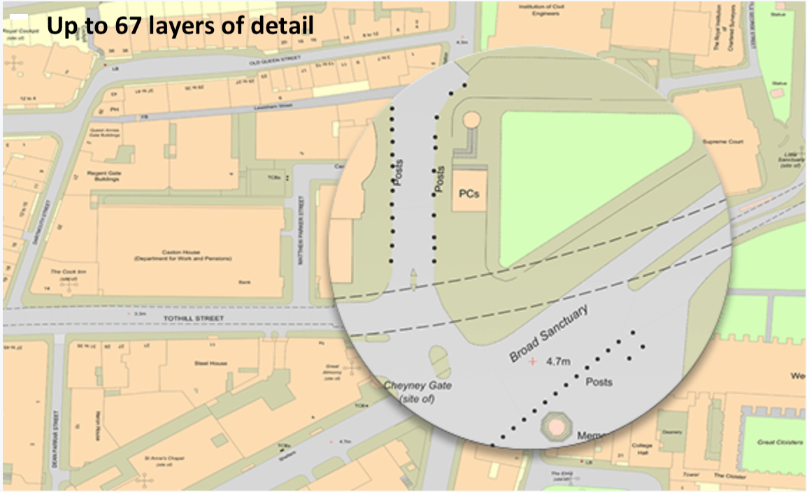
During the 2nd stage of the RIBA Plan of Works, the Design and Access Statement (DAS) is being prepared. This includes research on site history, local transport, sustainability, and site-specific information on climate for example wind, noise, and sun path. Large scale topographic mapping is always included in a Statement, usually showing the site analysis, the location of the project and its relationship to the surrounding buildings and area. Historical mapping, aerial photography, roof heights data and 3d mapping are also needed depending on the project and the scale of the development. Most of this information can be found on the website of MapServe®. We also provide a new map called Site Analysis map where valuable information can be found regarding transport, health services, educational institute and leisure facilities.
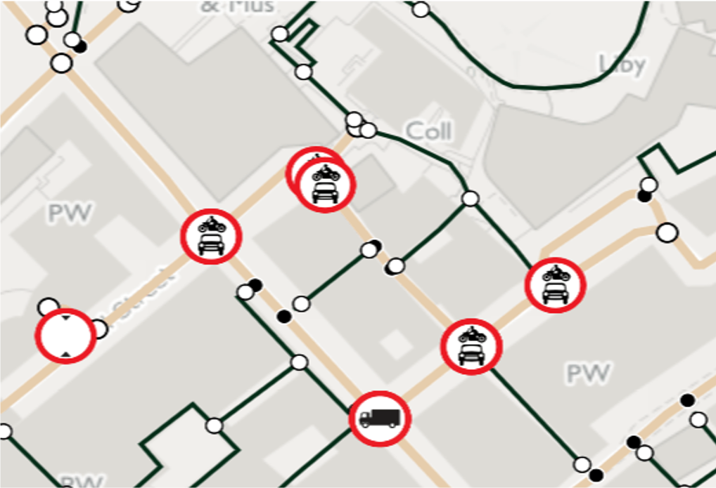
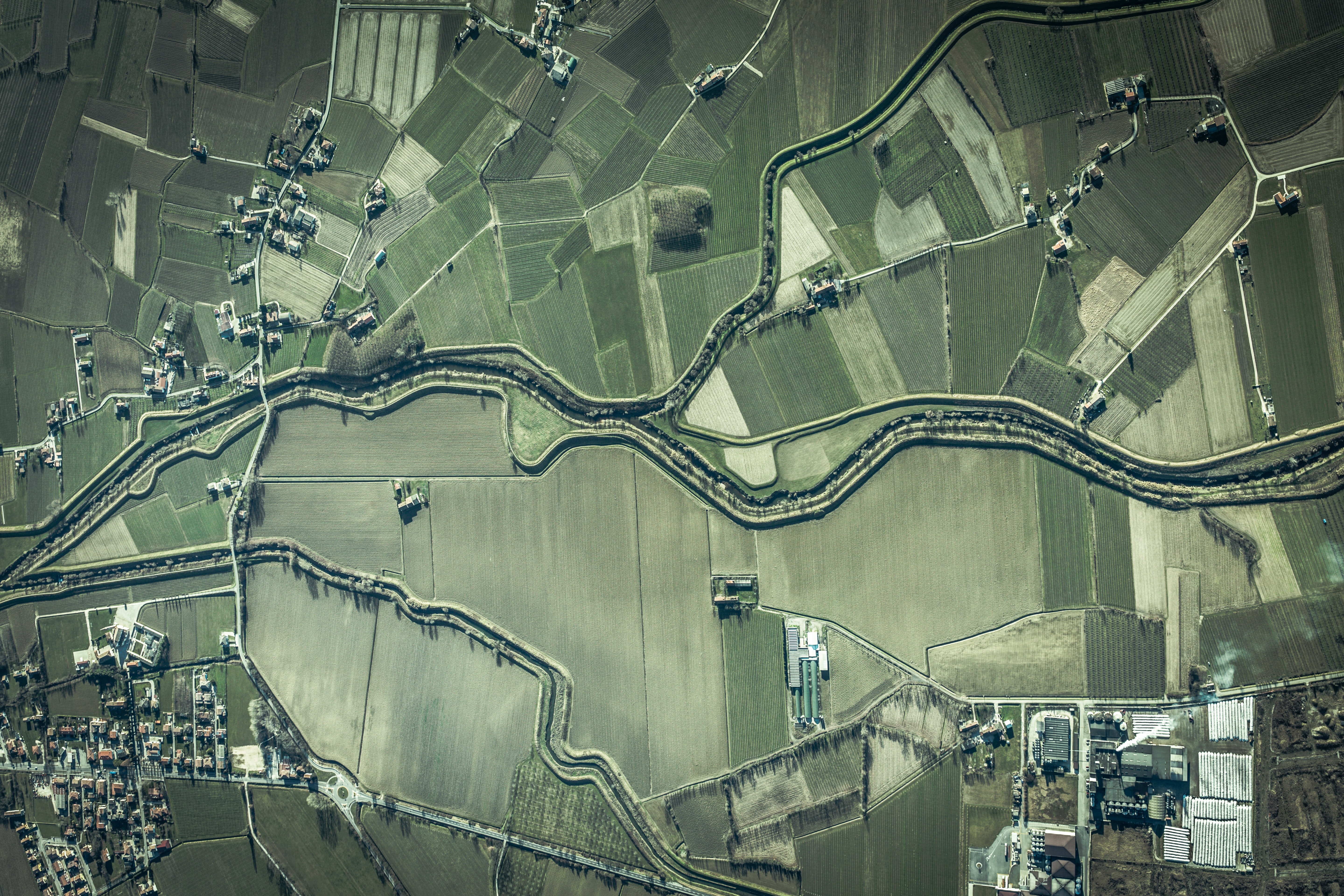
OS MasterMap® Highway Network Aerial Photography Large Scale Topographic Map (OS MasterMap®)
8 Tips on writing a good Design and Access Statement (DAS)
You can find the legal guidance to writing a good Design and Access Statement (DAS) here and on the Planning guidance website but to write a good Statement here are a few extra tips:
- Aim to keep it short and to the point.
- Write an original DAS for each application; you should not copy it from somewhere else as each project has its own requirements.
- Start the Statement as soon as you start the project scheme and use it to help influence the design.
- Explain how the design has originated and what you are trying to achieve through it.
- Get advice from different professionals. Consulting access specialists, locals, town planners early on will help the Statement stand out
- Use the Statement as a negotiation tool, and do not hesitate to change if the proposal changes/evolves.
- Use good quality and informative illustrations. Maps, diagrams and artistic sketches should be based on the application drawings.
- Many local authorities have requirements that differ from the national minimum. So it is always wise to check if further information is needed for a particular scheme. Not submitting a statement when required, or not providing the right information, will delay the application.