What is a site plan?
A site plan is an essential component of any set of architectural drawings. The site plan will frequently include details such as current and prospective structures, access, landscaping, site borders, and much more. It is a scaled design that depicts the current state of your land as well as suggested changes and the location of any existing and proposed development. If you intend to change parts of your property, you may need to create a site plan. Your site plan must show where your property lines are located in relation to any existing and proposed structures, parking, or other site features.
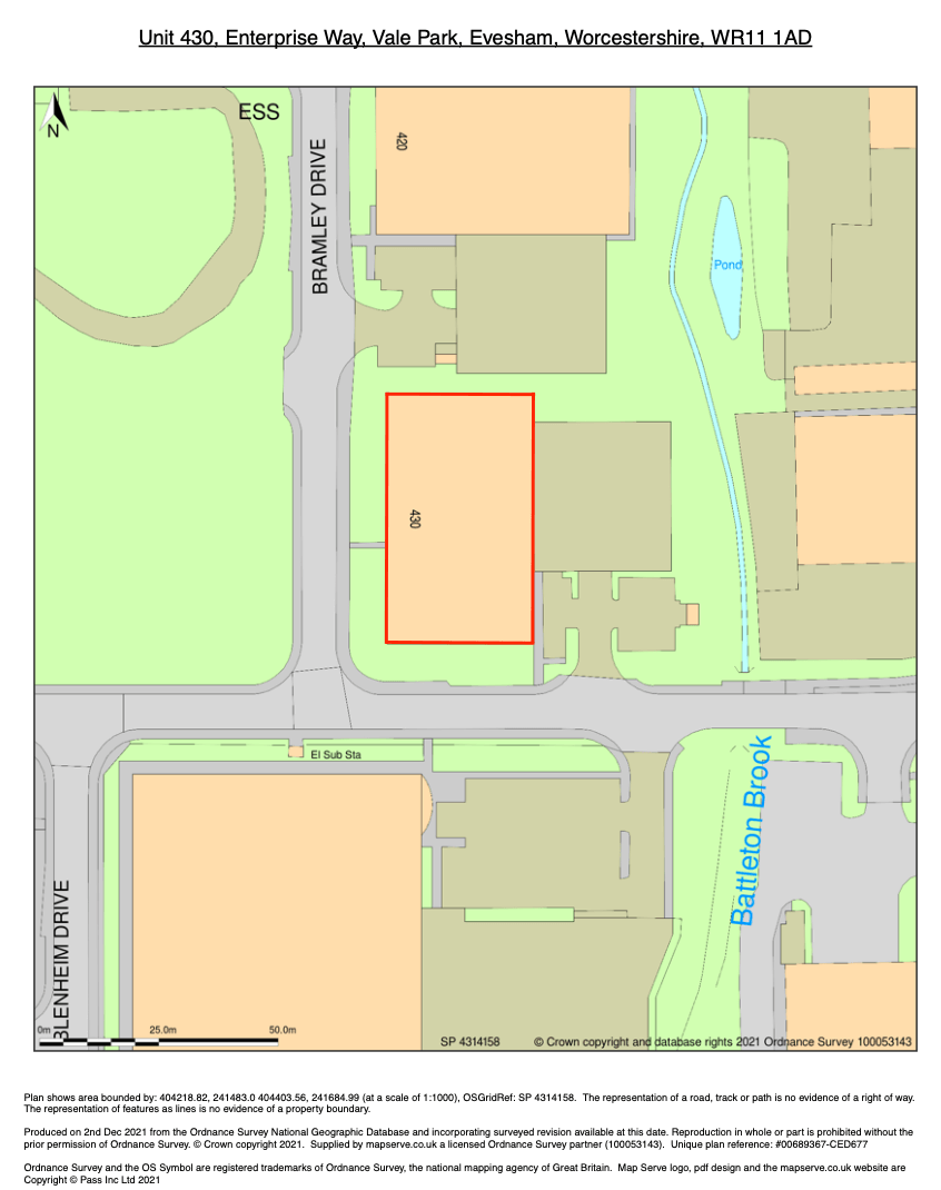
Download your site plan for every location in Great Britain here
1. Determine whether or not a site plan is necessary
Any building permit for new development or renovation that includes external work requires a site plan. For example, if you are reorganising your parking lot or constructing a new structure or extension, you must have a site plan.
If you need help to determine whether you require a site plan, you can contact your local planning office. A planner can assist you in determining what form of land use application you require to complete your project and can provide you with a land use application package to guide you through the land use process. Click to find planning instructions.
2. Determine the borders of your property and the measurements of your land
You can determine the size of your land from your title deeds. If you are unsure where to find those you can use MapServe® to determine those.
Using the Measure tool on our website, it's easy to find out the area or measure a plot of land in England or Wales, using our data which are sourced from the Ordnance Survey. Start by entering your Postcode or grid reference details on our search page. You will be directed to a page where your plot of land will be in the center of the map. You can find our measure tool on the toolbar at the top of the screen which will allow you to measure your property and add any boundary lines.
Another option would be to hire a surveyor to measure your land and your property.
3. Figure out the position of the buildings and the rest of the elements
You must identify the position of existing buildings, roadways, sidewalks, driveways, trees and other site features in relation to the property boundaries using your property boundaries and measurements. Calculate the distance between these site elements and the property lines that surround them.
4. Create your plan
Using all of the information you have gathered you can now create your site plan. You can draw your site plan by hand, use computer software or a licensed provider. A scaled site plan is required. The best option would be to get your site plan from a licensed partner of the OS such as MapServe®. You will need to sign up for an account first in order to create your plan.
5. Check your plans
Check that your plan is correct and has all the essential elements required. You can follow this guide here to make sure that everything is in order. You are now able to submit your plan to the local authority. You can check an example of a licensed site plan provided by MapServe below.