What is a standard Site Plan?
A site plan ( also known as a plot plan or a block plan) is a form of drawing used by architects, landscape architects, urban planners, and engineers to represent actual and projected conditions for a specific area, often a parcel of land that is to be altered. Buildings, roads, walkways and paths/trails, parking, drainage facilities, sanitary sewage lines, water lines, lighting, and landscaping and garden components are all commonly included on a site plan.
- what exists.
- what is being proposed.
- what needs to be demolished.
When applying for planning approval, the local authority has a standard need for drawings that offer information on the proposed changes. A Location Plan and Block Plan will almost certainly be necessary if you are filing a somewhat conventional planning application. This might also incorporate a site plan. A location plan is based on an ordnance survey map, which is typically printed at a scale of 1:1250 on an A4 sheet of paper. The suggested site will be highlighted in red on the location plan. It will also depict the size, a north point, and any important structures and roads that indicate the location of the planned site.
Get a site plan of your property here
What do I need to include in my Site Plan?
The following list includes suggestions on what to include in a site plan as well as some basic needs. All of these features are not necessarily required, but they can act as a checklist when you create your site ideas.
- a scale bar or graphic bar (usually at 1:200 or 1:500 scale)
- the intended development, all existing structures and buildings, any greenspaces and other open spaces
- any building proposals, clearly shown and identified
- the location and size of current and future hard-surfaced areas such as parking lots, turning lanes, and pathways
- an arrow pointing North
- any proposals regarding demolition of structures
- any trees planned to be removed
- tree information including their location,spread and species
- all roads, walkways, and public rights of way next to the site
- all existing buildings and structures on the property adjacent to the application location (Buildings and structures on surrounding land must be clearly represented unless the applicant can establish that the planned construction will have no influence or effect on them)
- Bin storage
- Cycle storage
- Fire access
- External lighting requirements
Which scales are best used for a Site Plan?
- 1:200 scale: ideal for a close-up of a tiny region or spaces smaller than 32 x 32 m
1:500 scale: better for a close-up of a certain region or areas the size of 80 x 80 m
Examples of a Site Plan
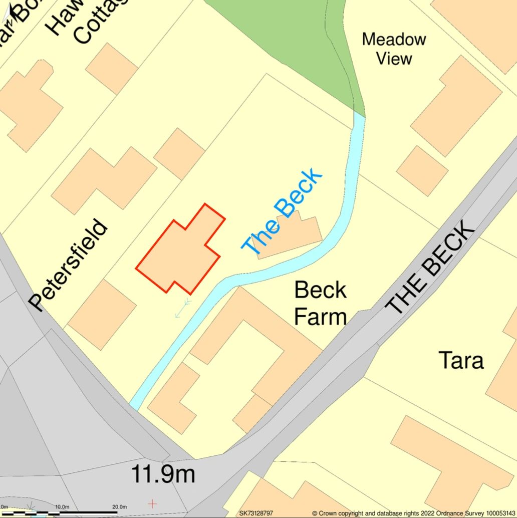
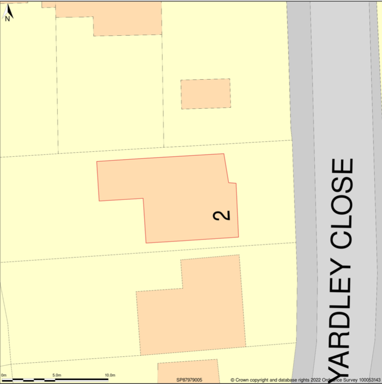
Site Plan at 1:500 scale Site Plan at 1:200 scale