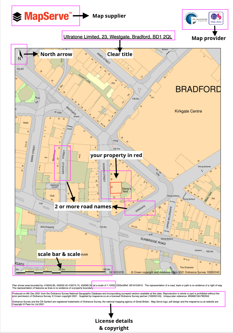
What is a location plan?
A location plan is a supporting document that a planning authority may need as part of a planning application. This might be in addition to or instead of a site plan and/or a block plan. It depicts the intended development in relation to its surrounding properties and features. This allows the planning authority to correctly identify the land to which the application refers, and is usually based on an up-to-date Ordnance Survey map. The map we use for your location plans is OS MasterMap.
A location plan should be produced on an A4 sheet using a specified standard metric scale, commonly 1:1250 or, for bigger locations, 1:2500. It is critical that the plan specifies the direction of the North in order for its alignment to be evident.
Download your location plan here
Typically, the plan will show the following:
- Roads and/or structures on neighbouring land
- The borders of the site.
- The land required to carry out the proposed development (outlined in red).
- Any other land owned by the developer near or adjacent to the location (outlined in blue).
A location plan differs from a site plan, which is focused on presenting greater detail about the development inside the site limits, or a block plan, which may provide a somewhat larger picture of the local region around the site.
How much does it cost?
Our plans starting price is £13.50 + VAT with a pay as you go account, or £11.25 with a professional account. You can check our price list here. If you would like to proceed and purchase a plan you need to sign up or login to your account and then search for the area that you want.
What format do I need to submit it in?
The best format to submit your location plan in is a PDF. You can order your PDF directly from us and attach it to your planning application. If you need your map in another format we can also supply it in PNG or CAD format.
What kind of map do I need to use?
Your local council will require up to date, high-quality mapping. At MapServe| MapServe® we supply location plans based on Ordnance Survey MaterMap® data. OS is the UK's national mapping agency and their coverage is unparalleled. We are licensed partners of the Ordnance Survey and the Planning Portal.