Site Plan
Site plans, also known as block plans or plot plans, show the intended development's location in respect to the property's boundaries. They are most often submitted in either a 1:200 or 1:500 scale.
Download your site plan within minutes here
Site plans should show the following:
- the size and location of the current building, as well as any proposed expansions, in relation to the property's border.
- specify the location and purpose of any other structures inside the property's boundaries.
- specify the location and width of any neighbouring roadways.
You may additionally need to provide the following (if the planned development would have an impact on it):
- Other existing structures on the property
- All public rights of way intersecting or adjacent to the location
- Position of any trees on the site and those on adjoining land
- Extent and nature of any hard surfacing
- Boundary treatment, including walls or fences
A site plan similar to alocation plan is one of the key papers that must be presented to the Local Planning Authority as part of the planning application's supporting documentation. Both plans are often the bare minimum for any planning application.
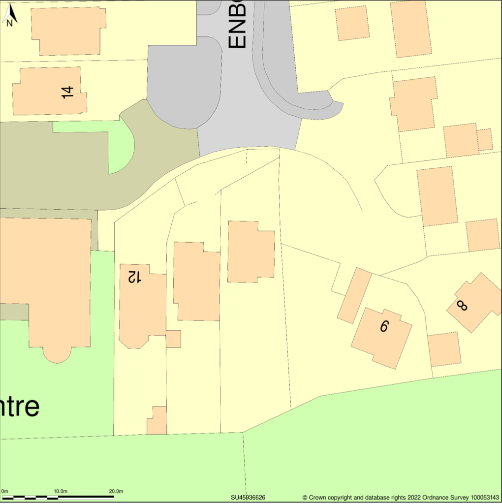
Site Plan at 1:500 scale
Location Plan
A location plan must be based on an up-to-date map and at a recognised standard metric scale, often 1:1250 or 1:2500, and must illustrate the planned development in relation to its adjacent properties. It is one of the most important documents that must be presented to the Local Planning Authority as part of the planning application's supporting materials.
Download your location plan quickly here
Also, you will need to:
- Outline the entire application site clearly with a red line (all land necessary to carry out the proposed development including access to the site from a public highway, visibility splays, landscaping, car parking and open areas around buildings)
- Outline with a blue line any other land owned by the applicant that is nearby or adjacent to the project's site.
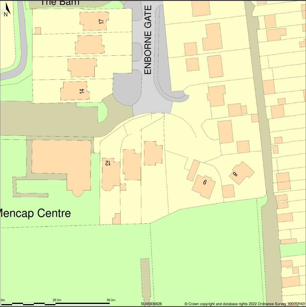
Location plan at 1:1250 scale
For all planning applications, the drawing's scale must be referenced along with a scalebar, otherwise, your local council may refuse to accept the proposal unless the drawings are amended. This has the potential to cause important delays to your planning application. If you are not certain that your plans are appropriate and accurate or if you need any assistance, you should seek guidance from your local planning authority.