The need to shift to more sustainable energy sources has never been greater. With growing worries about climate change and environmental deterioration, the need to shift away from reliance on fossil fuels and towards renewable energy sources has taken the stage. Mapping technology has emerged as a vital tool for evaluating optimal locations for sustainable projects, opening the way for a more sustainable and resilient energy future. This map shows all current, under construction, and awaiting construction renewable energy installations in the UK as of December 2018. In this article we'll discuss how mapping supports the selection of ideal areas for renewable energy efforts, underlining the relevance of mapping in the development of a greener and more sustainable world.
Download professional OS maps here
Location Analysis
Mapping technology has changed how we perceive and interact with our surroundings. Mapping, in addition to its usual applications such as navigation and geographic information systems (GIS), has found an essential role in renewable energy. At its core, mapping serves as the foundation for location analysis, a methodical process that involves studying and evaluating multiple geographic and environmental aspects to determine a site's suitability for renewable energy projects. The integration of several data sets, ranging from topographical features and climate trends to land availability and infrastructural accessibility, is required for location analysis. Experts can assess the feasibility and viability of a site for hosting renewable energy projects by combining these data sources. This rigorous methodology enables decision-makers to make well-informed decisions that optimise energy yields while minimising negative environmental impacts.
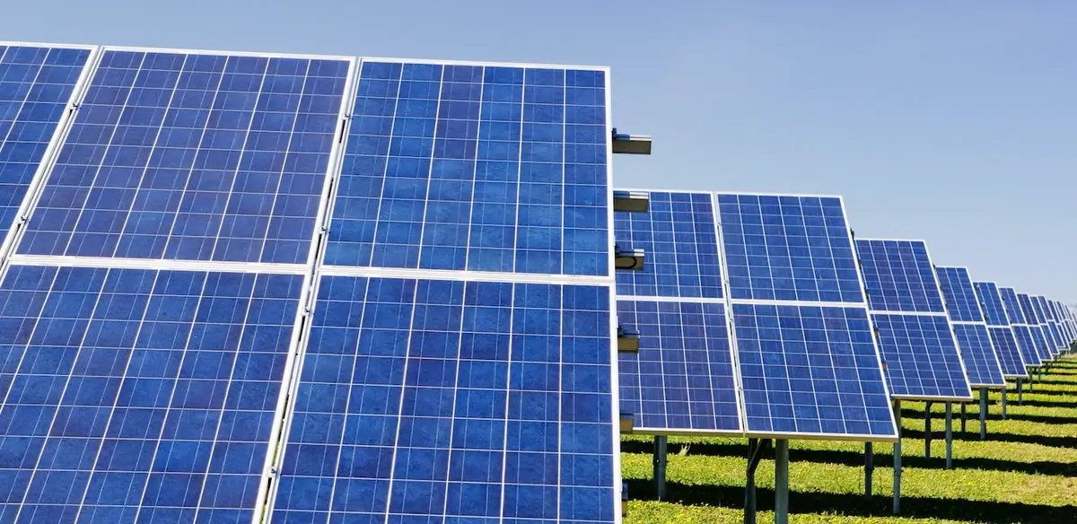
The Potential of Solar Energy
Solar energy is one of the most known applications of location analysis. Solar electricity, as harnessed by photovoltaic panels, is a clean and abundant renewable energy source. However, the amount of sunshine received by solar panels significantly impacts their efficiency. This is where mapping technology comes into play. Mapping technologies enable professionals to measure solar irradiance levels throughout various geographies, assisting in the identification of sites with optimal sun exposure. Solar energy projects can be strategically located in places that get the most solar energy by analysing solar radiation data, shading patterns, and cloud cover. This method not only improves the overall efficiency of solar panels but also provides a higher return on investment for renewable energy ventures.
Wind Energy
Mapping is critical in identifying sites with excellent wind conditions in the field of wind energy. Wind turbines thrive in places with persistent and strong wind patterns because they catch kinetic energy from the wind. The intricate interplay of wind currents and geographical features, on the other hand, needs a thorough grasp of suitable sites. Mapping technology helps estimate wind flow patterns by analysing terrain, elevation, and adjacent barriers. Experts can find places where wind energy installations would be most successful by mapping wind speed and direction data. This level of precision guarantees that wind turbines are properly positioned to capture the maximum amount of wind energy, contributing to the overall feasibility and success of renewable energy projects.

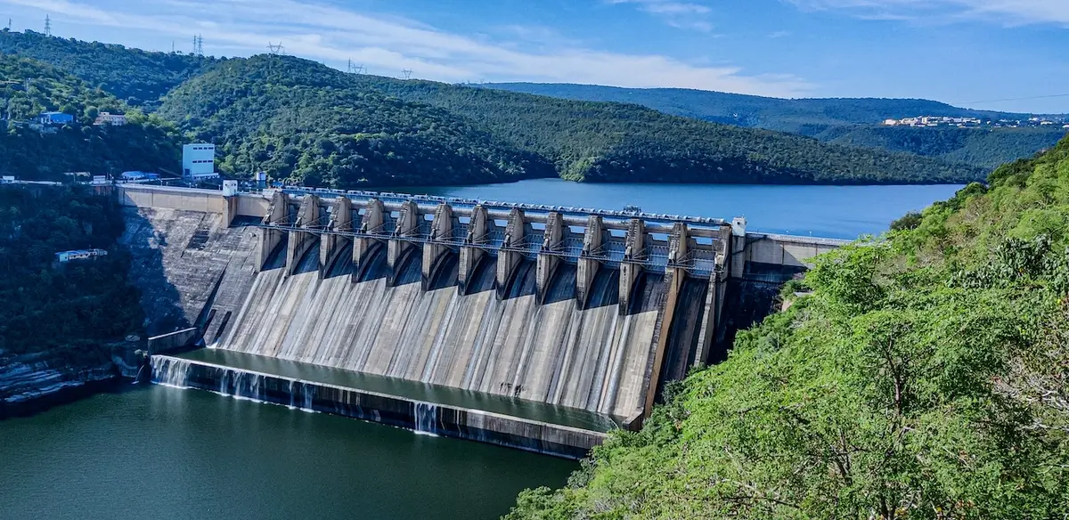
Hydroelectric and Geothermal Energy
Aside from solar and wind energy, location analysis is critical in other renewable energy sectors. Mapping aids in the identification of suitable sites for dams and reservoirs in hydroelectric power generating. Water flow rates, elevation fluctuations, and environmental issues are all thoroughly analysed to establish a location's potential for capturing hydroelectric energy. Mapping also aids in the exploration of geothermal energy sources. Geothermal energy is based on heat generated beneath the Earth's surface. Experts can use mapping technology to detect areas with high geothermal activity, such as geysers and hot springs. Potential geothermal energy locations can be examined by analysing subsurface heat patterns and geological formations, providing insights into the viability of this renewable energy option.
Economic and Environmental Considerations
Location analysis is important for reasons other than optimising energy yield. It also includes economic and environmental issues, which are critical in creating long-term projects. Mapping technology makes it possible to examine a wide range of parameters, including accessibility to current power infrastructure, projected energy consumption, and economic viability. Economically, mapping assists in locating sites that provide cost-effective integration with existing electricity infrastructures. Transmission lines and substation accessibility can have a significant impact on the viability and profitability of renewable energy projects. Mapping allows decision-makers to strategically locate installations, lowering infrastructure costs and increasing projects' overall financial feasibility. Furthermore, location analysis assists to ecosystem preservation and environmental effect reduction. Mapping helps avoid future conflicts with protected areas and sensitive habitats by identifying ecological sensitivities and biodiversity hotspots. This method assures that renewable energy projects respect and sustain the surrounding environment, in accordance with the ideals of sustainable development.
Stakeholder Collaboration and Community Engagement
Mapping technology also encourages collaboration and participation among the numerous parties involved in renewable energy initiatives. The open visualisation and communication of potential project sites can benefit governments, energy businesses, environmental organisations, and local people. Data visualisation through maps simplifies complicated ideas, allowing stakeholders to better comprehend the subtleties of renewable energy initiatives. This open discourse promotes educated discussions about project benefits, potential problems, and community concerns. As a result, mapping technology serves as a catalyst for inclusive decision-making processes that prioritise the needs and goals of all stakeholders.
The path to a sustainable energy future is fraught with obstacles and opportunity. Through location analysis, mapping technology has developed as a guiding compass in navigating these complications. Mapping enables decision-makers to determine the best locations for renewable energy projects involving solar, wind, hydropower, or geothermal sources by analysing geographic and environmental data. Solar energy installations can harness the full power of the sun, wind turbines can harness the power of continuous winds, hydroelectric facilities can be smoothly blended into landscapes, and geothermal resources can be tapped beneath the Earth's surface thanks to mapping. Furthermore, mapping assures that these projects are financially sustainable, environmentally responsible, and aligned with the goals of local communities. Clean power generation is essential to the UK's aim to achieve net zero emissions by 2050, with the government setting energy suppliers a target of 100% zero-carbon generation by 2035. This is a quarterly summary of the renewable energy project monitoring activities. Mapping technology is a steadfast ally in the search for a sustainable energy future, helping us through the challenges and opportunities on our journey to a cleaner, greener planet.