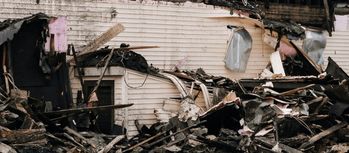
In recent months, the RAAC crisis in the UK has brought infrastructure assessment to the forefront of public consciousness. RAAC, or Reinforced Autoclaved Aerated Concrete, is a lightweight material widely used in construction between the 1950s and 1990s. Unfortunately, it has proven to be less durable than traditional concrete, with a lifespan of approximately 30 years. This has raised serious concerns about the safety of buildings that still rely on RAAC components. As the nation grapples with the consequences of this issue, mapping technologies have emerged as a critical tool for assessing and addressing infrastructure risks.
The integration of advanced mapping solutions into the world of infrastructure assessment in the UK has revolutionised how authorities and stakeholders identify vulnerabilities, prioritise repairs, and ensure public safety. For businesses specialising in digital maps, this crisis highlights the vital role of geospatial technology in creating a safer built environment. This article explores how mapping technologies can provide actionable insights into the RAAC crisis and beyond.
Download the latest OS digital maps here
Understanding the RAAC Crisis
The RAAC crisis has exposed the fragility of many public buildings, particularly schools, hospitals, and civic centres constructed during the mid-20th century. Unlike traditional concrete, RAAC is highly porous and susceptible to moisture ingress, leading to rapid degradation over time. The collapse of RAAC panels has resulted in closures, emergency repairs, and a scramble for funding to address safety concerns.
A key challenge in managing the crisis lies in identifying where RAAC was used, particularly when construction records are incomplete or unavailable. Without precise data, prioritising inspections and remedial work becomes difficult, putting both budgets and safety at risk. This is where mapping technologies can make a significant difference by providing accurate, efficient, and scalable solutions for infrastructure assessment in the UK.
Mapping for Infrastructure Safety
Mapping technologies encompass a wide range of tools, including Geographic Information Systems (GIS), LiDAR (Light Detection and Ranging), drone surveys and 3D modelling. These technologies are well-suited to infrastructure assessment, offering detailed visualisations and analyses that help decision-makers respond effectively to safety challenges.
1. Geographic Information Systems (GIS)
GIS platforms are indispensable for infrastructure assessment in the UK, particularly in the context of the RAAC crisis. By combining spatial data with construction records, GIS tools can create detailed maps highlighting buildings at potential risk due to RAAC use. For instance:
-
Risk Mapping: GIS can overlay maps of public buildings with data on construction dates and materials to identify high-risk zones.
-
Inspection Prioritisation: Using demographic data and building usage information, GIS can prioritise inspections for facilities with high foot traffic or critical services, such as schools and hospitals.
-
Maintenance Planning: GIS platforms can track ongoing repairs, ensuring that resources are allocated efficiently and progress is monitored in real time.
GIS mapping also supports collaboration among stakeholders by providing a centralised platform for sharing data. Engineers, architects, and government agencies can access up-to-date information to coordinate their efforts, thereby making the entire process of infrastructure management easier.
2. Drone Surveys
Drones equipped with high-resolution cameras and sensors offer a cost-effective way to inspect buildings for RAAC-related risks. Traditional inspections often require scaffolding, which is time-consuming and expensive. Drones, on the other hand, can capture detailed images and videos of roofs, ceilings, and other hard-to-reach areas without intrusive measures.
When paired with thermal imaging or LiDAR technology, drones can detect structural anomalies, such as cracks or voids, that indicate RAAC degradation. These surveys are particularly valuable for large or complex structures, where manual inspections may be impractical. Additionally, drone data can be integrated with GIS platforms to provide a comprehensive view of infrastructure safety across an entire region.
Drones also offer the advantage of rapid deployment, enabling assessments to be conducted in emergency situations. For instance, after the sudden collapse of a structure, drones can quickly survey the site and provide actionable data to emergency responders and engineers.
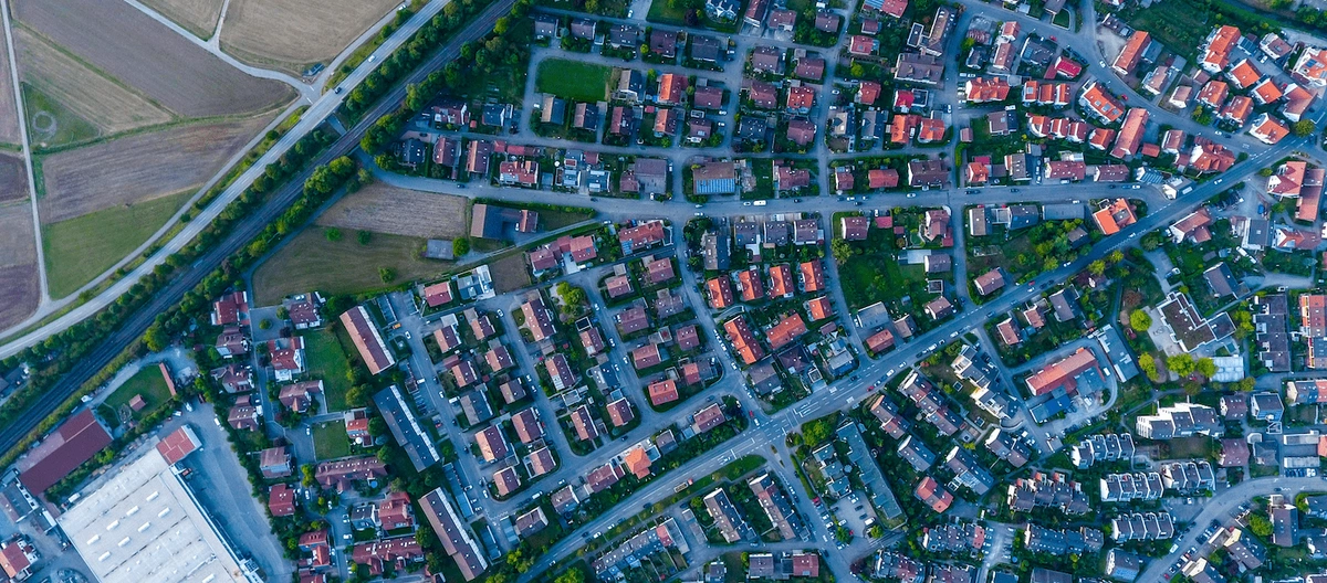
Aerial view using drones
3. LiDAR Technology
LiDAR is another powerful tool for infrastructure assessment. By emitting laser pulses and measuring their return times, LiDAR systems can create highly accurate 3D models of buildings and landscapes. These models allow engineers to:
-
Detect subtle deformations in RAAC panels that may not be visible to the naked eye.
-
Measure changes over time, helping to predict when structural failure might occur.
-
Evaluate the impact of environmental factors, such as moisture or temperature fluctuations, on building integrity.
LiDAR’s ability to generate detailed data quickly makes it an invaluable resource for large-scale infrastructure assessments, particularly during a crisis where time is of the essence. Additionally, the integration of LiDAR data into broader mapping systems can provide insights at both the micro and macro levels, ensuring no critical details are overlooked.
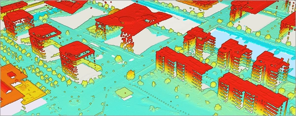
3D Model generated using LiDAR
4. 3D Modelling and Digital Twins
Digital twin technology, which involves creating a virtual replica of a physical structure, is gaining traction in the field of infrastructure management. By integrating data from GIS, LiDAR, and other sources, digital twins provide a dynamic, real-time view of a building’s condition.
In the context of the RAAC crisis, digital twins can simulate how different remediation strategies might affect a building’s stability. For example, they can model the impact of reinforcing RAAC panels or replacing them entirely, enabling engineers to choose the most effective solution. Digital twins also facilitate predictive maintenance by identifying potential issues before they escalate into costly repairs or safety hazards.
Furthermore, digital twins can be used for training purposes, allowing engineers and inspectors to practice identifying risks and testing solutions in a virtual environment. This can significantly enhance the overall quality and effectiveness of infrastructure management strategies.
Practical Applications in the RAAC Crisis
The benefits of mapping technologies in addressing the RAAC crisis are already becoming evident. Local authorities and private sector companies have begun leveraging these tools to:
-
Create RAAC Databases: By digitising historical records and combining them with geospatial data, stakeholders can build comprehensive databases of RAAC-affected buildings.
-
Streamline Inspections: Mapping technologies help prioritise inspections based on risk factors, ensuring that the most vulnerable structures are addressed first.
-
Enhance Public Communication: Interactive maps can be shared with the public to inform communities about infrastructure safety efforts and provide updates on repair progress.
-
Optimise Resource Allocation: By identifying clusters of RAAC-affected buildings, mapping tools enable more efficient deployment of inspection teams and repair crews.
In addition, these applications can serve as a blueprint for tackling other infrastructure challenges, such as addressing the risks associated with ageing bridges or flood-prone areas. By building on the lessons learned from the RAAC crisis, mapping technologies can contribute to more comprehensive and proactive infrastructure management nationwide.
The Role of Digital Map Providers
For companies specialising in digital maps, the RAAC crisis presents both a challenge and an opportunity. By offering tailored solutions for infrastructure assessment, these businesses can play a pivotal role in enhancing public safety and mitigating risks.
For example, digital map providers can develop custom GIS platforms that integrate historical construction data, real-time inspection results, and predictive analytics. These platforms can be designed with user-friendly interfaces, allowing non-experts to access and interpret complex geospatial data. Additionally, digital maps can be enhanced with layers that visualise RAAC risks, repair schedules, and other critical information.
Moreover, digital map providers can collaborate with government agencies and construction firms to ensure their tools are aligned with regulatory requirements and industry standards. By positioning themselves as trusted partners in this effort, digital map companies can help drive innovation in infrastructure assessment and management.
Looking Ahead
The RAAC crisis has underscored the importance of proactive infrastructure assessment and maintenance. While the immediate focus is on addressing the risks posed by RAAC, the lessons learned can be applied to other challenges, such as climate change resilience and ageing infrastructure.
Mapping technologies will continue to evolve, offering even more sophisticated tools for monitoring and managing the built environment. Innovations such as artificial intelligence, machine learning, and augmented reality are poised to enhance the capabilities of geospatial platforms, making infrastructure assessment faster, more accurate, and more cost-effective.
In the meantime, the integration of mapping solutions into the response to the RAAC crisis demonstrates their value as a cornerstone of modern infrastructure management. By harnessing the power of digital maps, the UK can not only address the immediate challenges of the RAAC crisis but also build a safer, more resilient future for generations to come.
Ultimately, mapping technologies represent not just tools for solving today’s problems but also investments in the UK’s long-term infrastructure security. With continued innovation and collaboration, they will remain an essential part of creating and maintaining a safer, more sustainable built environment.