How is OS MasterMap® surveyed?
Every day, a group of surveyors, pilots, and analysts tour the nation in search of variations in topography, taking measurements and recording these changes in the Ordnance Survey's database. This continuous research offers the public the most detailed, updated, and comprehensive geographic dataset of the UK, OS MasterMap® Topography Layer, after it has been organised and processed.
View and download OS MasterMap® of your area here
What exactly is OS MasterMap® Topography Layer?
OS MasterMap® Topography Layer, the most complete geographic dataset of the United Kingdom, was intended to offer companies, governments, and organisations with a precise representation of the whole country. Customers using this dataset include energy and utility businesses, architects, developers, insurance, emergency service providers, government agencies and tourist organisations.
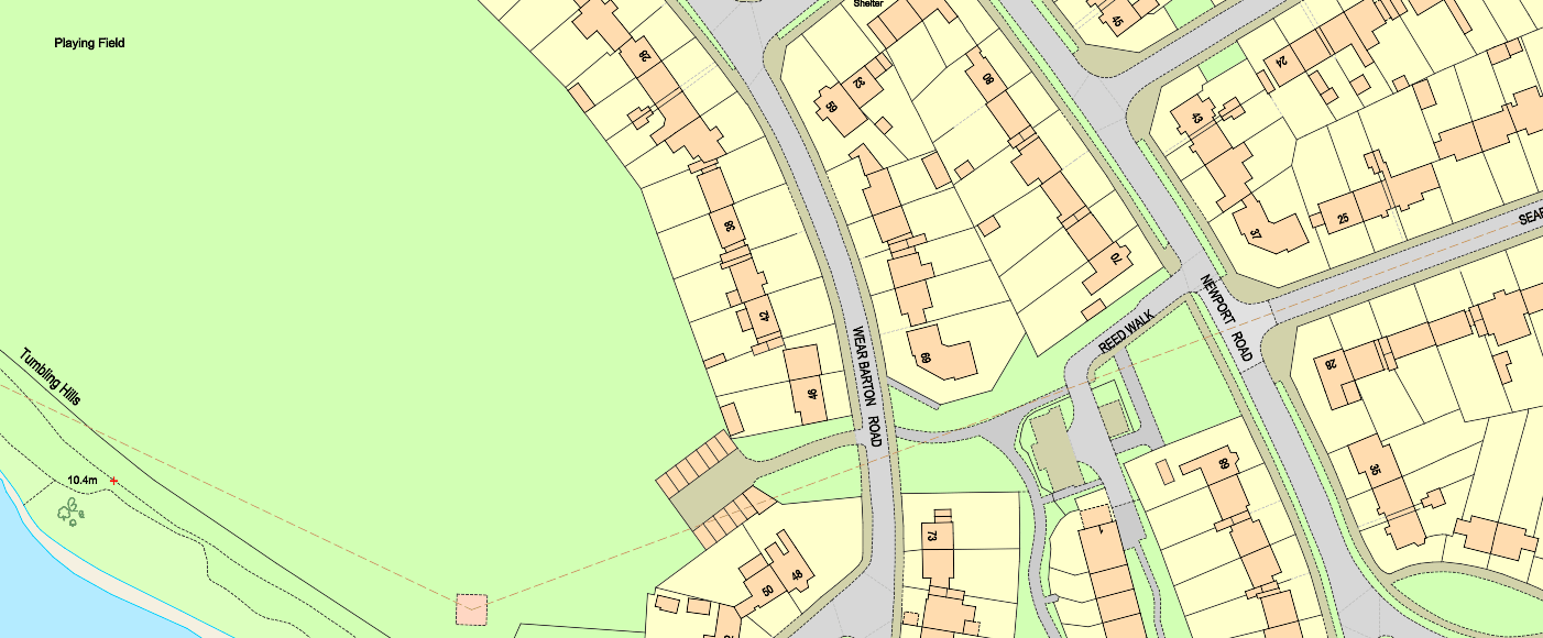
A point, line, or polygon that represents a real-world feature is the basic unit of OS MasterMap® Topography Layer data. A feature may also be accompanied by words or a symbol. Both are regarded as features of the OS MasterMap® products. Each feature is accompanied by a set of attribution that offers information about the real-world item it represents, as well as metadata that aids in the tracking of changes to the feature. The structure of OS MasterMap® Topography Layer, together with its extensive attribution, allows for the execution of rather complicated geographic studies, as well as the enhancement of users' data-capture procedures. Attribution allows you to utilise the data for more than just a map.
What is the accuracy of OS MasterMap®?
Ordnance Survey ensures that OS MasterMap® data is never more than six months out of date due to constant testing. In terms of extent and detail, this mapping project is unique. Every 2 weeks, the OS MasterMap® Topography layer is updated. OS MasterMap®'s update dates can be found here. So far, around 440 million TOIDs have been allocated, and the database has a capacity of 600 TB.
| Original Survey Scale | 99% confidence level | 95% confidence level | RMSE* |
| 1:1250 | |||
| Absolute accuracy* | 0.9 m | 0.8 m | 0.5 m |
| Relative accuracy* | +/- 1.1 m (up to 60 m) | +/- 0.9 m (up to 60 m) | +/- 0.5 m (up to 60 m) |
| 1:1250 | |||
| Absolute accuracy | 2.4 m | 1.9 m | 1.1 m |
| Relative accuracy | +/- 2.5 m (up to 100m) | +/- 1.9 m (up to 100 m) | +/- 1.0 (up to 100 m) |
| 1:10000 | |||
| Absolute accuracy | 8.8m | 7.1m | 4.1m |
| Relative accuracy | +/- 10.1 m (up to 500 m) | +/- 7.7 m (up to 500 m) | +/- 4.0 m (up to 500 m) |
*Absolute accuracy: how closely the coordinates of a point in the dataset agree with the coordinates of the same point on the ground (in the British National Grid reference system).
*Relative accuracy: positional consistency of a data point or feature in relation to other local data points or features within the same or another reference dataset.
*RMSE (root mean squared error) is the square root of the mean of the squares of the errors between the observations.
Features of OS MasterMap®
OS MasterMap® is made up of 500 million distinct features, each with its own Topographic Identifier (TOID). This identification is associated with that feature all through its existence and is decommissioned when the feature is eliminated, such as when a building is demolished. This permanent identification is valuable because it enables analysts, developers, and data scientists to cross-reference topographic properties across databases and history.
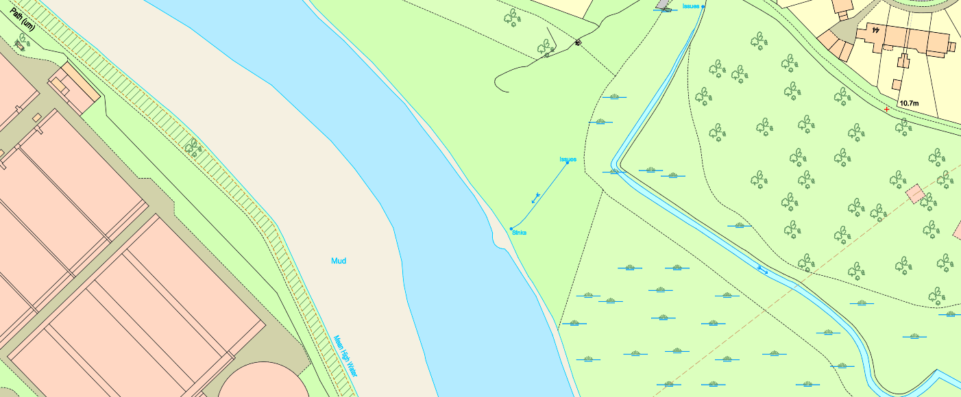
The 9 layers of OS MasterMap®
- Administrative boundaries like parliamentary constituencies
- Buildings
- Heritage and antiquities sites
- Land and landforms like parks, golf courses, slopes, cliffs, gardens and woodlands
- Railways
- Roads, tracks, pathways
- Various structures such as pylons or fountains
- Point height features
- Water features like ponds & rivers