We are happy to announce that soon we will be launching Ordnance Survey Historic mapping on MapServe®. You will be able to get historical overviews of your site by browsing our range of old mapping. Looking at a historical map is like stepping into the past. We may use them to analyse changes in our cities and landscapes over time and gain valuable knowledge about the past. Historical mapping can also be used for:
- Demonstrating the evolution of a town from early on
- Historical interest
- Geographical research
- Academic research
- How modern landscape blends and interacts with older foundations
- Coastal erosion studies
- Heritage statements
- Boundary disputes
Historical maps since the 19th century are available here
Here are the different historical mapping options you can get from MapServe®:
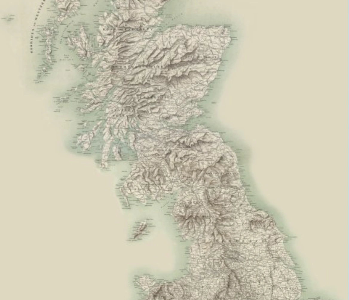
OS Great Britain in the 1900s
Five different scales of Ordnance Survey mapping of Great Britain from the 1900s. This set can show the various scales at several zoom levels.
- Ordnance Survey, Great Britain, 1.016 Inches to 16 miles / 1:1 million, It was published in 1905.
- Ordnance Survey Quarter-Inch England and Wales / Scotland 1:253,440, It was published between 1900-1906.
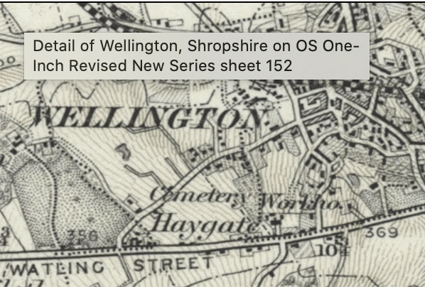
- Ordnance Survey One-Inch to the Mile England and Wales (Revised New Series) / One-Inch Scotland 2nd edition (Hills), 1:63,360, It was published between 1885-1903.
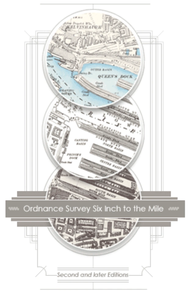
- Ordnance Survey Six-Inch to the Mile England and Wales / Scotland, 1:10,560, It was published between 1888-1913.
OS Great Britain after the 1900s
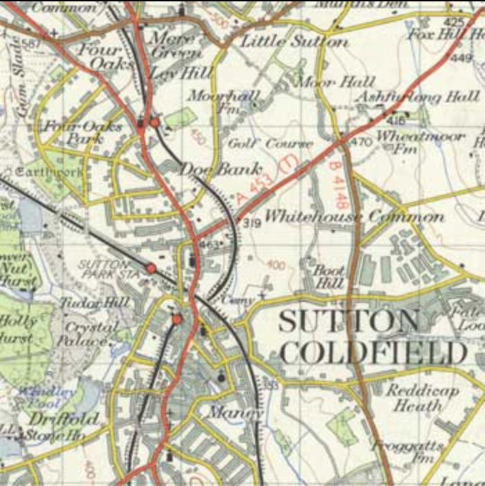
In addition to covering all of Great Britain, this seamless layer is also the largest-scale layer in the OS Great Britain, Ordnance Survey in the 1900s mapping (See above). On top of it, there is a layer of OS County Series maps from the 2nd edition of 1888-1913 at a scale of six inches to the mile / 1:10,560. All of Great Britain is covered by this series, which is the most detailed topographic mapping. Not all regions were covered by the OS 25 inch-per-mile maps and town plans. They are extremely useful for local and family history, as they show most of the landscape's elements.

OS Great Britain, One inch to the mile, 'Hills Edition'
All of Great Britain is covered by this 1 inch per mile layer, which appears as the third layer out of four in the Great Britain, Ordnance Survey 1900s map (see above). One-Inch to the Mile England and Wales (Revised New Series) and One-Inch Scotland 2nd edition (Hills), 1:63,360, 1885-1903 make up this layer. Using a one-inch to a mile scale, you may get a fair picture of the landscape by looking at the patterns of settlement, roads, railways parks and woods, and the general lay of the land. It served military and civilian functions, as well as governmental, administrative, scientific and recreational users, and was produced by Ordnance Survey. Road classification was one of the most significant adjustments from the previous New Series sheets.
OS Great Britain 'Provisional'
As the first civilian map series at this scale, the 1:25,000 "Provisional edition" or "First Series" was produced by Ordnance Survey. It served as a predecessor to the present Explorer and Outdoor Leisure maps. When it was first introduced in 1956, it covered 80% of Great Britain, with the exception of the Highlands and Islands of Scotland. If you're interested in seeing a detailed map of rural and urban areas, this series is for you. This is the smallest scale at which field borders may be clearly displayed in rural regions, allowing footpaths, tracks and bridleways to be easily followed. You can choose between conifers and deciduous or mixed woodlands. You can also see elements of archaeological interest such as cairns, earthworks and standing stones.

OS Great Britain Seventh Series
The Ordnance Survey 'Seventh Series' mapping of Great Britain displays a great preview of the landscape in the 1950s. It was the only standard one-inch to the mile (1:63,360) uniform series to cover the whole of Great Britain and it was the last of the OS's one-inch maps before they replaced it in the 1970s with the 1:50,000 scale mapping.
It was a conventional topographic authority and included information on land use, industry, quarries, farms, pubs, roads, railways, canals and parks and gardens, as well as relief and woodland. The one-inch series served both military and civilian applications, as well as for official, administrative, scientific, and recreational purposes. By covering a bigger area than the basic large scales, this series is particularly effective for providing an overview of key landscape features such as metropolitan areas, highways and railways, as well as patterns of woodlands, orchards, and formal parkland, and rough pasture land.
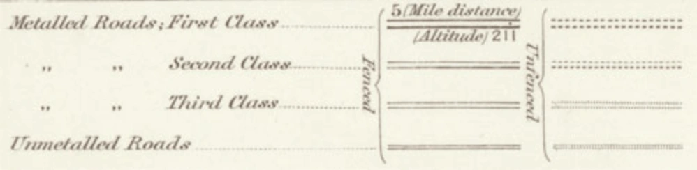
Seven categories of information were shown on the 'Seventh Series' maps, including:
- Motorways, trunk roads, class 1 and class 2 main highways, minor roads, and untarred/unmetalled roads were represented in greater detail than on the New Popular.
- Multiple track, single track, and narrow gauge railways were portrayed in greater detail than on the New Popular.
- At 50-foot intervals, brown contour lines were drawn on the map along with spot heights in feet above mean sea level (MSL). Since 1953, spot heights have been differentiated between those that have been levelled and those that have not.
- With distinct forms of black lines, national, county and parish boundaries were shown.
- Walkways and tracks were shown using a black dashed line. As of 1960, some sheets began to include public rights of way (marked in red) from the rising local authority Definitive Maps of Public Rights of Way.
- Pre-roman, Roman, and post-roman antiquities were initially separated by font style; this was simplified to just Roman and other antiquities in 1958.
- Churches, towers, windmills, and lighthouses, as well as post offices and telephone booths, were depicted on early one-inch maps.
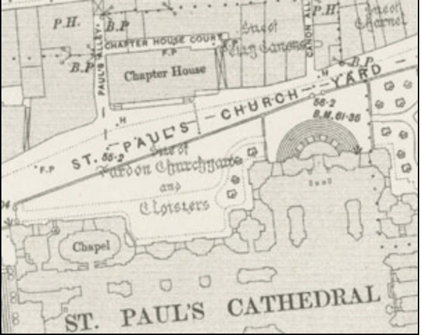
OS London, Five-foot to the Mile
The most comprehensive mapping of London by the Ordnance Survey, dating just over a century ago, encompassing the city in 729 sheets and based on a revision and survey that took place in 1944-1948. Because the maps are so important for improving urban sanitation, they include various elements related to water supply, sewerage, drainage, and gas supply, such as fire plugs, hydrants, water taps, manholes, stop-cocks, spot-heights, and benchmarks. The maps depict all building divisions, including terraced residences, with glass roofed buildings shown with cross-hatching and they also present the ground floor layouts of public structures such as cathedrals, churches, and train stations as well as public boundaries.
The five-foot-to-mile scale, or 1:1,056, was ten times larger than the OS six-inch-to-mile mapping (1:10,560), which had become the standard for all OS rural mapping. Although the nationwide mapping of towns with more than 4,000 inhabitants at the metric ten-foot scale (1:500) was authorised at the beginning of 1855, towns originally surveyed at the five-foot scale, such as London, were frequently revised at the same size for the next editions. At the 1:1,056 scale, an inch on the map measured 88 feet on the ground, which means that each sheet covered an area of 743,424 square yards (0.24 square miles).