The Ordnance Survey is Britain's national mapping organisation. It conducts official surveying in the United Kingdom, giving the most precise and up-to-date geospatial data on which the government, business, and individuals rely. OS is a public organisation of the Department for Business, Energy, and Industrial Strategy.
While Ordnance Survey data is extremely valuable for large-scale mapping and navigation, it has restrictions due to its nature and is unlikely to be precise enough for development needs. A 1:200 scale measured land survey should be accurate to +/- 5 cm. However, OS maps are excellent to use for a planning application and initial site analysis even though they cannot be as accurate as a measured survey of an area in the UK.
Access the latest OS MasterMap® here
OS MasterMap®
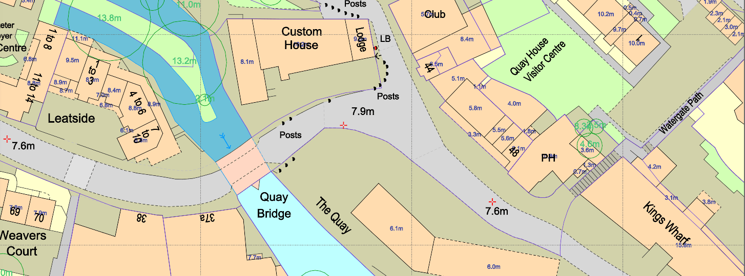
OS MasterMap® sample
OS MasterMap® is the most important product produced by the Ordnance Survey. It is a map that covers the whole of the United Kingdom and gets updated every two weeks. It is the most detailed map available, providing a comprehensive database that records every fixed feature in the United Kingdom larger than a few metres, all presented in a single continuous digital map.
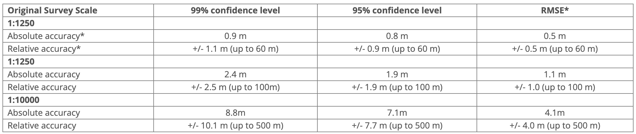
OS MasterMap® accuracy table
Ordnance Survey has started a Positional Accuracy Improvement initiative during in the last years. The goal was to make their maps more compatible with GPS-derived locations. The major consequence is that the grid lines are moved relative to the remainder of the map content, with little influence on the map's accuracy.
In border disputes, the perfect accuracy of a map is unimportant. This is due to the fact that a high level of absolute precision ensures that the map depicts a house in the exact place relative to the owner's holiday home in another area. In border disputes, relative accuracy is crucial. Is the fence positioned correctly in relation to the residences on each side of it? Over many years, the Ordnance Survey has assessed the absolute and relative correctness of a wide sample of its published National Grid Series maps. As a result, they issued an accuracy disclaimer for its larger-scale maps in 1997.
You can read all about OS MasterMap® here.
How can I use OS maps correctly?
A correct interpretation of the map usually leads to the conclusion that the line on the map identifies the physical feature to which the boundary is related, and the position of the actual feature on the ground – not the position of the line on the map – determines the position of the boundary that follows the feature. Even so, you must first ensure that the legal border follows the physical feature and that you are not dealing with a physical feature that only indicates a broad boundary that is somehow related to a nearby legal boundary.