Maps have a wide variety of applications, including:
Navigation
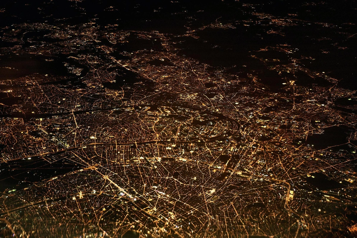
Maps are used to help people find their way from one place to another, whether they are traveling by car, foot, or some other mode of transportation.In today's fast-paced world, finding our way from point A to point B has become more accessible than ever, thanks to the wonders of mapping technology. Whether you're traveling by car, foot, boat, or plane, maps are the guiding stars that lead us through uncharted territories, bustling cities, and even challenging terrains. In this blog post, we will delve into how mapping is revolutionizing navigation and making our lives easier and more exciting.
1. GPS Navigation Systems: Your Trusty Travel Companion Imagine embarking on a road trip to an unfamiliar destination without a GPS navigation system guiding you. Sounds daunting, doesn't it? GPS (Global Positioning System) devices and smartphone apps have revolutionized the way we navigate, making getting lost a thing of the past. By utilizing satellite signals and digital maps, these systems accurately pinpoint your location and provide real-time turn-by-turn directions to help you reach your destination with ease.
2. Online Maps: The Virtual Travel Planner Google Maps, Apple Maps, and other online mapping services have become our go-to travel planners. With just a few taps on your smartphone, you can effortlessly find the best routes, estimate travel times, and even locate nearby points of interest. Whether you're exploring a new city or planning your daily commute, these online maps ensure you're always on the right track.
3. Offline Maps: Navigating the Unconnected Paths Internet connectivity may not always be available, especially when you're off the beaten path. But fear not! With offline maps, you can download maps for specific regions in advance. Once downloaded, your navigation app will still use GPS to guide you without relying on a data connection.
4. In-Car Navigation Systems: A Co-Pilot for the Modern Driver Modern vehicles are equipped with built-in navigation systems, offering seamless integration with digital maps. Gone are the days of fumbling with paper maps while driving! In-car navigation systems provide real-time guidance, traffic updates, and even suggest alternate routes to help you reach your destination efficiently and safely.
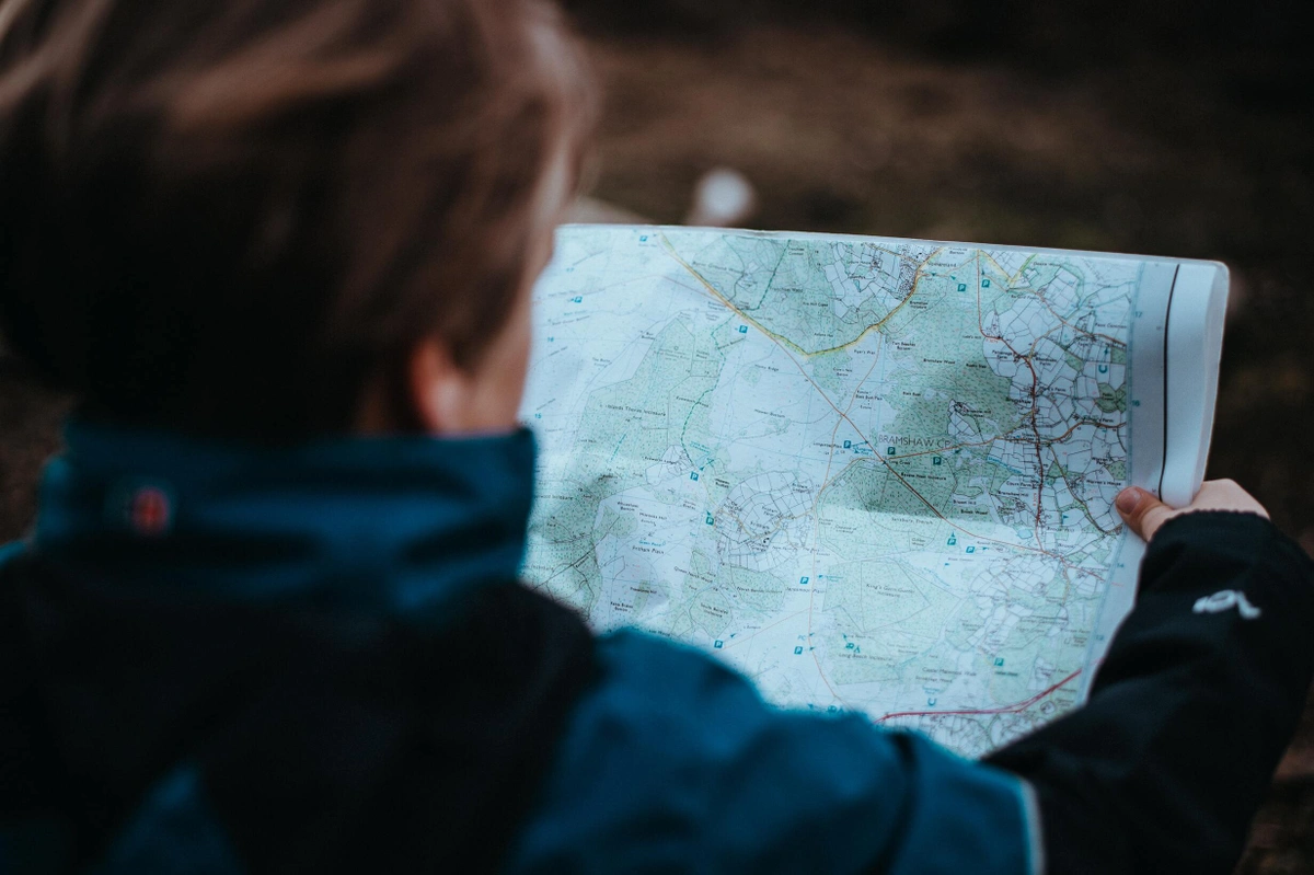
5. Exploring the Great Outdoors: Topographic Maps for Adventurers For the adventurous souls who love hiking, mountain biking, or trekking, topographic maps are a lifesaver. These specialized maps showcase elevation, terrain features, and landmarks, empowering outdoor enthusiasts to conquer challenging terrains and reach their outdoor goals.
6. Sailing the Open Waters: Mapping the Marine World Navigating vast oceans can be daunting, but marine maps make it manageable. Sailors and boaters rely on these nautical charts to find their way, avoid hazards, and locate safe harbors.
7. Taking to the Skies: Aeronautical Navigation For pilots soaring through the skies, aeronautical charts are their trusty companions. These specialized maps provide vital information about airspace, navigation aids, and terrain elevations, ensuring smooth and safe flights.
8. Responding to Emergencies: Mapping for Disaster Relief During times of crisis, mapping technology becomes a vital tool for emergency response teams. Maps aid in coordinating relief efforts, locating affected areas, and planning efficient evacuation routes to save lives and mitigate damage.

Spatial analysis
Maps can be used to analyse and understand patterns and relationships in spatial data, such as the distribution of population, economic activity, or natural resources. They have been an integral part of human civilization for centuries, helping us navigate and explore our surroundings. However, their significance extends far beyond simple navigation. In the digital age, maps have evolved into powerful tools for spatial analysis, allowing us to uncover hidden patterns, trends, and relationships within geographic data. In this blog post, we will dive into the world of spatial analysis and explore how maps are transforming the way we interpret and make sense of the world around us.
1. Spatial analysis, which is a technique used to analyse and interpret geographic data to gain insights into spatial patterns and relationships. It involves examining the distribution, density, proximity, and interactions of various geographic features. This process is particularly valuable for understanding complex phenomena influenced by location, such as population distribution, environmental changes, urban planning, and disease spread.
2. Unleashing the Power of Geographic Information Systems (GIS): Geographic Information Systems, commonly known as GIS, are the backbone of modern spatial analysis. These sophisticated tools allow us to capture, store, manipulate, analyze, and visualize geographic data on digital maps. GIS integrates various data sources, including satellite imagery, GPS data, demographic statistics, and more, providing a holistic view of any geographic phenomenon.
3. Spatial Data Visualization: Insights at a Glance Visualizing spatial data on maps brings clarity to complex information. By layering different datasets on a single map, patterns emerge that might otherwise remain hidden in traditional tabular data. Maps can display data in the form of choropleth maps, heat maps, scatter plots, and more, making it easier to grasp spatial patterns and identify trends at a glance.
4. Urban Planning and Infrastructure Development: Spatial analysis is an indispensable tool for urban planners and policymakers. By analyzing demographic data, transportation networks, and environmental factors, they can make informed decisions about city development, infrastructure projects, and resource allocation. Maps allow them to assess the impact of proposed changes on various communities and make more equitable and sustainable decisions.
5. Environmental Conservation and Management: Understanding the geographical distribution of natural resources, biodiversity hotspots, and environmental threats is crucial for effective conservation. Maps help environmentalists and researchers analyze spatial data to identify areas at risk, plan protected areas, and develop strategies for sustainable land use.
6. Public Health and Disease Mapping: In the realm of public health, spatial analysis plays a pivotal role in disease tracking and outbreak management. By mapping disease occurrences and analyzing demographic and environmental factors, health professionals can identify high-risk areas, allocate resources efficiently, and implement targeted interventions to curb the spread of infectious diseases.
7. Retail and Marketing Strategies: Retailers and marketers leverage spatial analysis to optimize their strategies. Mapping customer locations, competitors' locations, and demographic data allows them to identify the most suitable locations for new stores, personalize marketing campaigns, and improve overall customer experience.
Planning and decision making
Maps are often used to help plan routes, allocate resources, and make decisions about land use, development, and other issues. Effective planning and informed decision-making are essential for individuals, businesses, and governments to thrive. Among the numerous tools available to aid in this process, maps have proven to be invaluable assets. Maps go beyond mere navigation tools; they serve as powerful instruments to analyse data and support strategic planning and decision-making across various sectors. In this blog post, we delve into the significance of maps in planning and decision-making processes, exploring how they help optimize routes, allocate resources, and guide development efforts.
1. Route Optimisation and Navigation: Maps have been our go-to tools for route optimization and navigation for centuries. Whether it's a road trip, delivery service, or emergency response, maps help us find the most efficient paths to reach our destinations. Advanced mapping technologies, such as GPS systems, provide real-time traffic updates, alternative routes, and estimated arrival times, enabling individuals and businesses to save time and resources during their journeys.
2. Resource Allocation and Management: For businesses and governments alike, efficient resource allocation is critical for success. Maps aid in visualising data related to demographics, infrastructure, and economic factors, facilitating the identification of areas with high demand for resources or services. This information allows for targeted resource allocation, ensuring that resources are distributed where they are needed most, optimising their impact and minimizing waste.
3. Land Use Planning and Development: Maps play a pivotal role in land use planning and development projects. They provide a comprehensive view of existing infrastructure, zoning regulations, and natural resources. For urban planners, this spatial data aids in designing sustainable cities, allocating space for residential, commercial, and recreational areas, and implementing projects that align with long-term goals.
4. Environmental Impact Assessment: In an era focused on sustainability and environmental conservation, maps offer valuable assistance in assessing the impact of various activities on ecosystems. From analyzing deforestation patterns to monitoring wildlife habitats, maps provide a spatial context that helps researchers and policymakers make informed decisions to protect the environment.
5. Crisis Management and Emergency Response: In times of crisis, maps become indispensable tools for emergency response teams. During natural disasters, disease outbreaks, or humanitarian crises, maps help in visualizing affected areas, coordinating rescue efforts, and deploying resources efficiently. Real-time mapping technology aids in making quick decisions, ultimately saving lives and minimising damage.
6. Market Analysis and Business Expansion: For businesses, maps are powerful aids for market analysis and expansion strategies. When analysing geographical data, businesses can identify potential customers, map out competitor locations, and decide about opening new branches or expanding their operations into untapped markets.
Communication and visualisation
Maps are a useful tool for communicating information and ideas, and they can help to visualize complex data in a way that is easy to understand. In today's data-driven world, the ability to convey information and ideas effectively is more crucial than ever. Complex data can often feel overwhelming and difficult to interpret, but there is a powerful tool that comes to the rescue - maps. They possess a unique ability to transform intricate data into clear and visually appealing representations, making complex information easy to understand. In this blog post, we explore how maps serve as a valuable tool for communication and visualisation, impacting diverse areas of our lives.
1. Visual Storytelling: Maps are more than just a collection of geographic coordinates; they are a medium for visual storytelling. By incorporating data layers, colors, and symbols, maps can narrate compelling tales. Whether it's representing historical journeys, tracking the spread of a pandemic, or showcasing global trends, maps paint a vivid picture that resonates with people across all backgrounds and ages.
2. Simplifying Complex Data: Raw data can often appear overwhelming, leaving individuals struggling to make sense of its underlying patterns. Maps offer a simplified and intuitive solution. Through the use of visual elements, maps distill complex information into accessible forms, eliminating the need for data experts and allowing anyone to grasp the core insights at a glance.
3. Enhancing Decision-Making: Informed decision-making requires a comprehensive understanding of the available information. Maps play a pivotal role in this process by providing a holistic view of data. Whether it's city planners determining optimal locations for infrastructure or businesses identifying potential markets, maps empower decision-makers to analyze multiple factors simultaneously, leading to more strategic and impactful choices.
4. Bridging Language Barriers: Language can be a significant barrier when conveying information globally. Maps, however, transcend linguistic boundaries. By presenting information visually, maps become a universal language of communication, fostering cross-cultural understanding and collaboration.
5. Navigating Crisis Management: During times of crisis, when every second counts, maps become indispensable tools for crisis management. Whether it's a natural disaster, humanitarian emergency, or health pandemic, maps offer real-time visualization of affected areas, available resources, and response teams' locations, enabling authorities to coordinate relief efforts swiftly and efficiently.
6. Promoting Data Transparency and Accessibility: Maps make data accessible and comprehensible to a broader audience. They promote data transparency and accountability, allowing citizens to engage more actively in discussions around critical issues and encouraging data-driven advocacy for social and environmental causes.

Education and research
Maps are used in education to help students learn about geography, history, and other subjects. They are also used in research to study and understand various phenomena, such as population dynamics and climate change. Maps hold a significant role in education and research, acting as powerful tools to convey complex information in an easily digestible manner. From the exploration of geography and history in classrooms to the analysis of population dynamics and climate change in research labs, maps offer an invaluable resource to enhance learning and deepen our understanding of the world. In this blog post, we explore the multifaceted uses of maps in education and research and their impact on expanding knowledge across diverse subjects.
1. Enriching Education: In the realm of education, maps serve as a dynamic medium for spatial learning. By visualizing geographical concepts, historical events, and cultural phenomena, maps provide students with a deeper and more engaging understanding of the subject matter. From exploring ancient civilizations' migrations to comprehending the interconnectedness of ecosystems, maps foster curiosity and critical thinking, making learning a captivating journey of discovery.
2. Navigating Geography and History: Geography and history are inseparable companions, and maps seamlessly bridge the gap between these disciplines. Historical maps offer a glimpse into the past, illustrating the expansion of empires, trade routes, and territorial changes over time. Meanwhile, contemporary maps allow students to contextualize historical events and understand the impact of geography on shaping cultures and societies.
3. Unraveling Phenomena Through Research: Maps are essential tools in research, enabling scientists and scholars to study and analyze various phenomena. In the realm of population dynamics, demographic maps visualize population density, migration patterns, and urbanization trends, supporting policymakers in planning for sustainable development and resource allocation.
4. Understanding Climate Change: Maps play a crucial role in comprehending climate change and its effects on the planet. Climate models, temperature variations, and changes in ecosystems are visualized through maps, helping researchers and the public grasp the urgency of environmental challenges. Such maps drive advocacy for climate action and promote a deeper appreciation for the Earth's fragile balance.
5. Spatial Analysis and Data Visualization: Maps are powerful tools for spatial analysis, allowing researchers to identify patterns, trends, and anomalies in various datasets. By overlaying different layers of information, researchers can visualize relationships between variables and gain valuable insights into complex systems, such as urban development, natural resource management, and disease spread.
6. Geospatial Technology Advancements: With the advent of advanced geospatial technology, maps have taken on a whole new dimension. Geographic Information Systems (GIS) and Remote Sensing have revolutionized data collection and analysis, allowing for real-time mapping and spatial monitoring of various phenomena. These technologies open up endless possibilities for interdisciplinary research and informed decision-making.

Military and emergency response
Maps are used by the military for planning and logistics, and they are also used by emergency responders to plan and coordinate responses to emergencies. They have been indispensable tools throughout history, guiding explorers, travelers, and armies alike. In modern times, maps continue to serve as invaluable assets, playing a critical role in military planning and logistics as well as aiding emergency responders in coordinating their responses to crises. For comprehensive military and tactical mapping resources, visit this link to explore a wealth of valuable information and tools. In this blog post, we delve into the multifaceted uses of maps by the military and emergency responders, highlighting how these cartographic tools contribute to effective strategies, save lives, and protect communities.
1. Military Maps: Maps are foundational instruments for strategic planning and tactical brilliance. By providing a comprehensive visual representation of the battlefield, maps empower military leaders to analyze terrain, identify potential obstacles, and determine the best approach for achieving their objectives. Topographical maps, aerial imagery, and GIS technology allow for real-time intelligence gathering, ensuring adaptability in rapidly changing environments.
2. Logistics Optimisation: Maps are equally vital in military logistics, where efficient movement of troops, supplies, and equipment is crucial for success. Through route planning and coordination, military personnel can optimize their deployment and minimize risks. Maps enable them to identify logistical hubs, assess transportation infrastructure, and strategize for troop movements in both offensive and defensive operations.
3. Emergency Responders: In times of crises, emergency responders rely on maps to coordinate their responses and allocate resources effectively. Whether dealing with natural disasters, pandemics, or other emergencies, maps provide a real-time understanding of the affected areas, guiding responders' actions with precision. They help in setting up command centers, deploying rescue teams, and strategically positioning medical facilities to ensure timely aid reaches those in need.
4. Preparing for the Unpredictable: Maps are pivotal in disaster preparedness, allowing emergency responders to plan for potential scenarios and anticipate challenges. By mapping out vulnerable regions, potential evacuation routes, and access to critical resources, responders can devise comprehensive disaster management plans to mitigate the impact of calamities.
5. GIS in Emergency Response: The integration of Geographic Information Systems (GIS) in emergency response has transformed crisis management. GIS technology enables real-time tracking of incidents, dynamic mapping of evolving situations, and the fusion of diverse datasets. With GIS, emergency responders can harness the power of big data to make data-driven decisions and optimize their actions for maximum impact.
6. Training and Simulations: Maps are indispensable tools for training military personnel and emergency responders. Through simulated scenarios, maps help them practice decision-making, coordination, and response strategies in a controlled environment. Such training builds resilience, improves teamwork, and enhances preparedness for actual events.